Mount MacFarlane Climb 2024- Why it can be dangerous to do in rainy season

Mount McFarlane View from the Summit

Climbing Mount McFarlane in British Columbia


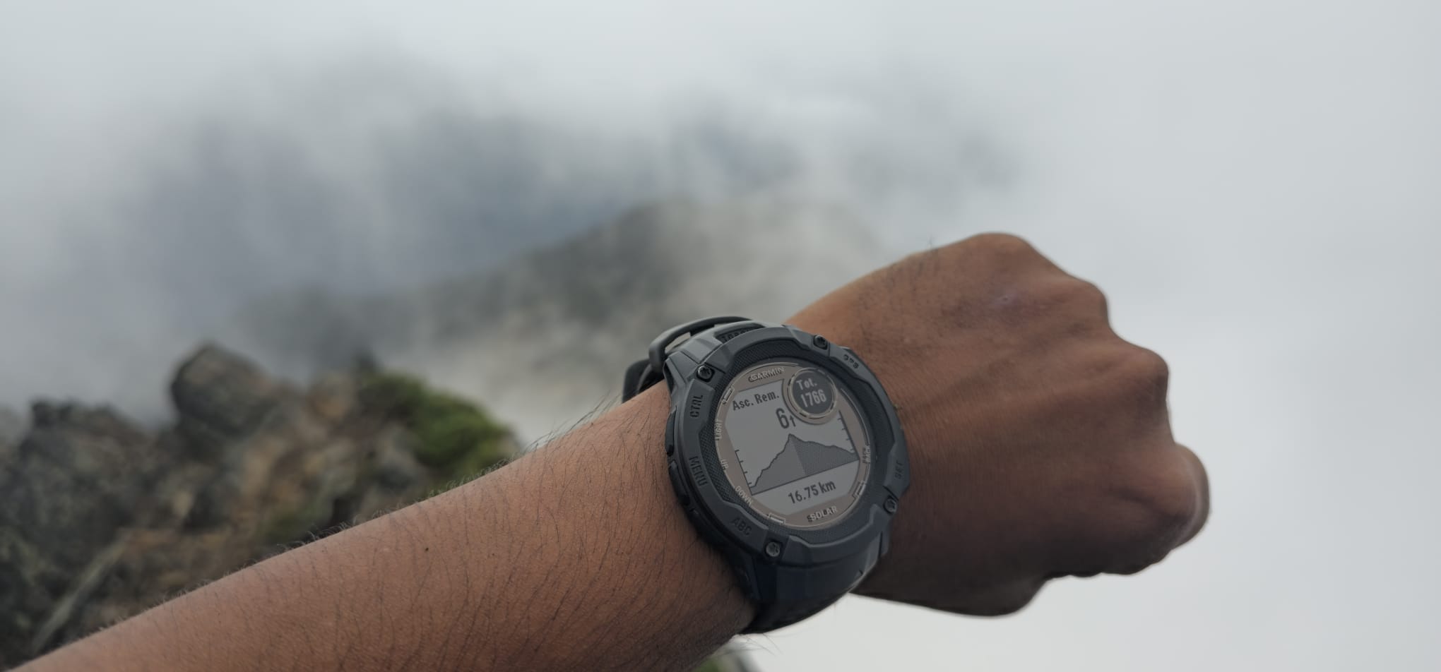
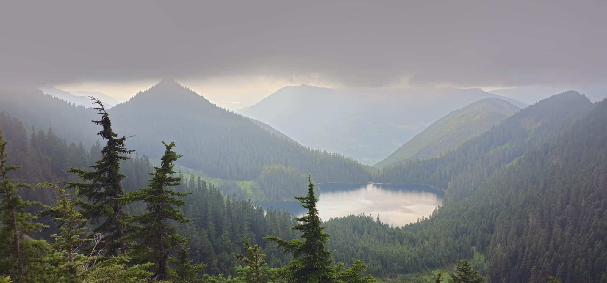
Mount McFarlane Summit is a Grade 3 Climb with rest of the mountain a hard hike. The combination of towering peaks 360 degrees across the Summit, lush valleys, and at least grade 3 Climb make reaching the summit of Mount McFarlane a rewarding experience for any climber. I had attempted Mount MacFarlane a few years ago but turned around from upper pierce lake because of the shortage of time. Even if I did 300 feet per hour vertical climb at that time, I won’t be able to make it down to the forest in day light and I did not want to descend in dark merely because the forest can be slippery depending on the weather. So, this time I was determined to make it to the summit through the forest, a lot of forest.

Forest, a lot of forest

Bridge at approximately 3km from the forest service road

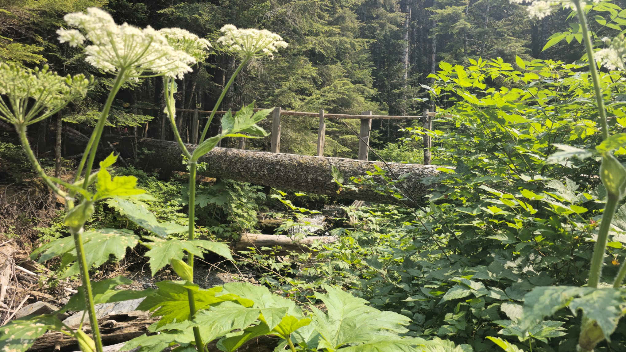
If you look at my GPX, there is a section where I ascended from left side of a Talus field and descended back onto the main trail. I would suggest you go straight onto the descending trail and skip the Talus field. That itself is a grade 4 climb through the bushes. So, you end up bush-wacking and climbing rocks to get to the main trail and it gets exhausting for rest of the hike. This time I did not find Mount MacFarlane forest as steep as it was the last time or I was really unfit at that time. The Summit push to Mount MacFarlane peak is a never ending affair. The final ridge starts with a climb then there is an easier grade then a climb and so on.

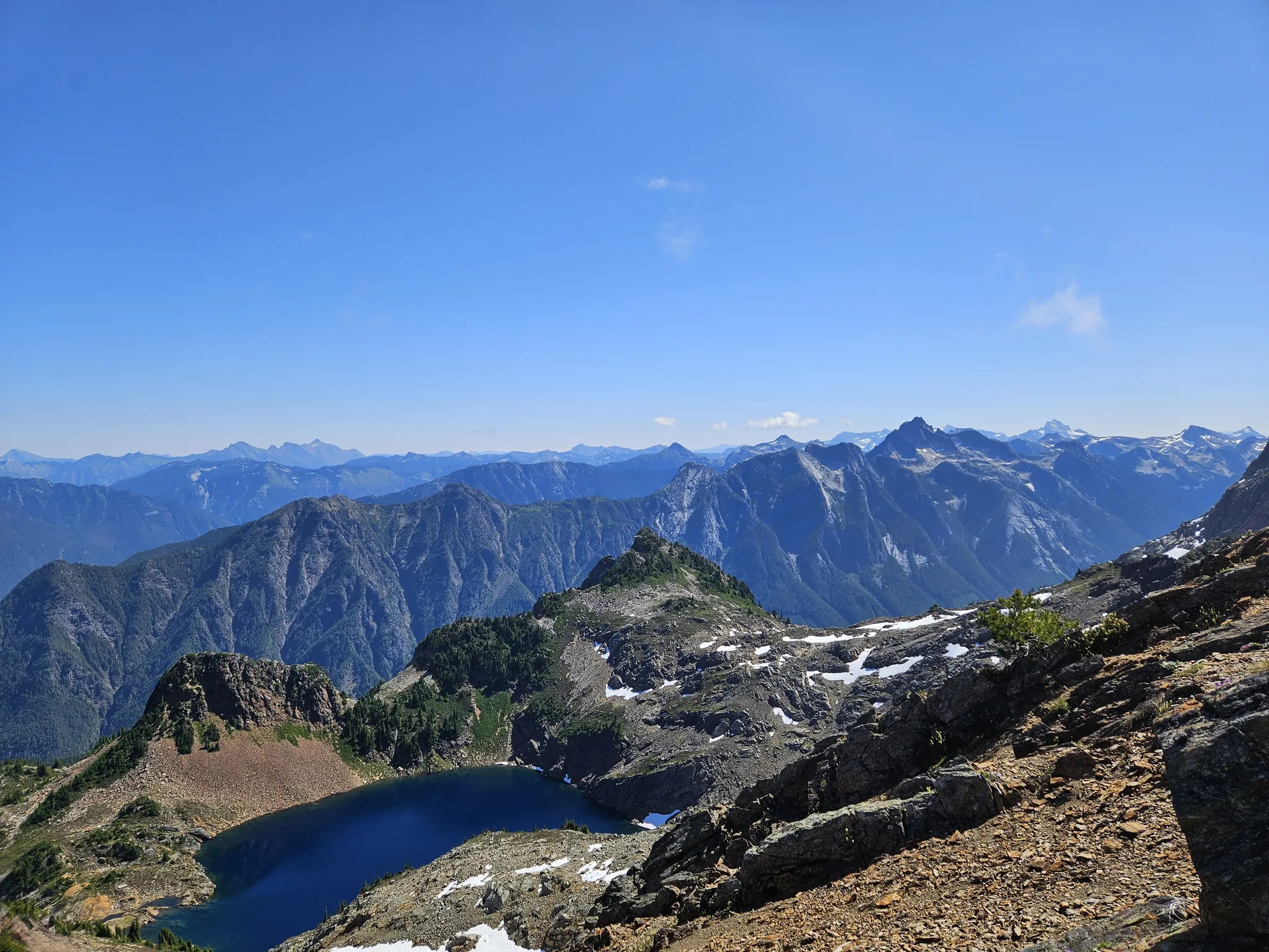
There was a separate small False Mount MacFarlane Summit where I went to just see if my altimeter changes to 1 meter altitude left to climb or I should have just jumped in the air.

What do you see from the Summit?

On the Summit of Mount McFarlane:

  1. Panoramic Mountain Views: The summit provides sweeping views of the surrounding mountain ranges, including the Fraser Valley, Chilliwack River Valley, and the Cascade Mountains.
  2. Fraser River: On clear days, you can spot the Fraser River meandering through the valley below, adding a stunning contrast to the lush green landscape.
  3. Chilliwack Lake: To the south, Chilliwack Lake is often visible, glistening amidst the dense forests and rugged terrain.
  4. Wildlife and Flora: The area around the summit is rich with alpine flora and occasionally wildlife sightings. The diverse plant life adds a vibrant splash of color, especially during the blooming seasons. If you time your hike well, witnessing a sunrise or sunset from the summit can be a truly magical experience, with the sky painted in hues of orange, pink, and purple.

GPX link to a downloadable course map.

Summit of Mount MacFarlane Altitude Meter on Garmin Instinct Tactical Solar
Watch
Mount McFarlane Upper Pierce Lake View

What are the conditions like? Difficulty, Distance, Preparation questions.

Pierce Lake covered with Cloud an instant change in weather
  1. Trailhead: The hike typically starts from the Elk-Thurston trailhead, located near Chilliwack. It’s important to check for any trail updates or conditions before you go. The GPX file I have uploaded is an actual route that goes from the parking lot to the lush forest to the right then up back to the forest service road and then back into the forest hiking switch backs. There is a sign on a tree that says 1km, that sign is actually the distance between the forest service road to the tree. What that means is when you come back there is another one kilometre to go to the parking lot after you reach the forest service road.
  2. Difficulty: The climb is challenging. It involves a significant elevation gain, loose rocks, sometimes it is not marked well. You can easily miss the trail and go on a washout and will have to climb back (grade 3) to the trail.
  3. Distance: The round trip is approximately 18 kilometres. With all the walking on the summit, across the upper lake, it made around 19.5 kilometres. You’ll need a lot of water. It’s a full-day hike, so starting early is advisable.
  4. Views: Panoramic views of the surrounding mountains and valleys. On a clear day, you can see far into the distance, making the effort worthwhile.
  5. Preparation: Make sure to bring plenty of water, snacks, and proper hiking gear. Weather can change quickly in the mountains, so layers and rain gear are recommended. Always let someone know your plans before heading out to this trail and consider carrying a map, compass, or GPS device. Cell phone coverage may be unreliable in certain areas.The area is home to various wildlife, including bears and cougars. It’s important to be aware of your surroundings and know how to react if you encounter wildlife.

Way points from bottom to top starting from 1km mark.

1km mark at Mt. MacFarlane from the service road onto the trail switchbacks that never comes at the descend
Mount McFarlane Upper Lake Cascades View

This post was last modified on October 8, 2024 8:32 pm

Sandhu Harpreet

Author

Recent Posts

Brandywine Mountain

Download Brandywine GPX File Brandywine Mountain is located in the Coast Mountains' Pacific Ranges. There…

7 months ago

Elk Mountain

Download Elk Mountain Map GPX File Elk mountain has prominence of only 32m and relatively…

7 months ago

Tao Te Ching- Chapter 01-Verse 02 (I-IV)

Chinese Text: 天下皆知 美之為美,斯惡已。皆知善之為善,斯不善已。故有無相生,難 易相成, 長短相較,高下相 傾,音聲相和,前後相隨。是以聖人處無為之 事,行不言之教;萬物作焉而不辭,生而不有。為而不恃,功成而弗居。 夫唯弗居,是以不去。 English Text: I- All in the…

7 months ago

Tao Te Ching- Chapter 01-Verse 03 (I-III)

Chinese Text: 不尚賢,使民不爭;不貴難得之貨,使民不為盜;不見可欲,使心不亂。 是以聖人之治,虛其心, 實 其腹,弱其志,強其骨。常使民無知無欲。使 夫1知者不敢為也。為無為,則無不治。 English Text: I- (Keeping the people at rest)…

7 months ago

Tao Te Ching- Chapter 01-Verse 01 (I-IV)

Chinese Text: 道可道,非常道。名可名,非常名。無名天地之始;有名萬物之母。故常 無欲,以觀其妙;常有欲,以觀其徼。此兩者,同出而異名,同謂之玄。玄之又玄,衆妙之門。 English Text: I-The Tao that can be trodden is not the…

7 months ago

Frosty Mountain E1 Hike-Hozameen Range E C Manning Park

Download GPX MAP of Frosty Mountain When not to go - *important* View-of-two-small-lakes-formed-of-Glacial-water from Summit…

8 months ago

This website uses cookies.