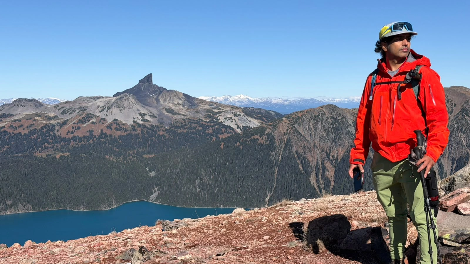
We chose Mount Price over Three Brothers as the autumn window narrowed. What began with an easy-paced climb to Garibaldi Lake became a long day of overgrown trail, boulder fields, frozen snow and red scree turning to mud. We reached Mount Price, visited Clinker’s ridge and returned tired, with two slips on the ascent and more difficult footing on the way down. The views were among my favourite in Garibaldi Park; finding our way through the quieter backcountry was a substantial part of the outing.
Distance: 30.3 km on Strava
Elevation gain: 1,778 m on Strava
Total elapsed recording: 11 hr 16 min 18 sec
Strava displayed time: 9 hr 4 min
Recording start: 6:54:01 a.m. PDT
Recording finish: 6:10:19 p.m. PDT
Highest GPS reading: 2,050.2 m, on Mount Price
Our difficulty assessment: Strenuous, with route-finding and consequential frozen footing
These figures describe our outing, including backtracking and a visit to Clinker’s ridge. The GPX measures 30.36 km and approximately 1,994 m of unsmoothed cumulative ascent. Strava’s processed gain is listed separately. The public embed labels its 9 hr 4 min figure “Time”; the complete GPS timestamp span is 11 hr 16 min. Neither a watch altitude nor a GPS maximum is a surveyed mountain height.
Choosing Mount Price and starting before sunrise
We had two objectives in mind: Three Brothers in Manning Park and Mount Price above Garibaldi Lake. Seasonal vehicle access on Blackwall Road was part of the Three Brothers decision, while recent snow was already changing the higher terrain around Price. We gave Mount Price priority. Its quieter backcountry approach appealed to us, and we wanted to use the conditions while we still could.
I woke around 3 a.m. and finished preparing before we headed toward Squamish. On the way, we bought food and noticed that the prices were noticeably higher than at other locations of the same franchise. I will leave its name out. It was one purchase, but it reminded me to plan food costs as well as the mountain day when heading into the Sea to Sky corridor. We like a warm meal after a hike; what we carry for hours on the mountain is a separate consideration.
The trailhead was still dark. In summer, I might have wanted to start hiking around 3 a.m. and reach Garibaldi Lake for sunrise. This time, we deliberately avoided going that early. We understood that roughly 20 centimetres of snow had fallen on Mount Price a few days before, and I was concerned about shaded rocks and ground that might still be frozen.
The GPS recording began at 6:54 a.m. We climbed at an easy pace, keeping energy for the less obvious terrain beyond the lake. Sunrise came while we were on the established trail.
Garibaldi Lake: wind, shells and the start of route-finding
We followed the branch toward Garibaldi Lake rather than Taylor Meadows. Taylor Meadows camping was closed, while Garibaldi Lake remained an option. BC Parks’ seasonal notice closes the Taylor Meadows campground and day-use area from September 1 to October 31 but permits hiking through; it should not be read as a closure of every trail in that area.
At the lake, the wind and cold became more noticeable. We put on our Gore-Tex shells, which made a useful difference by blocking the wind. I kept reminding us to drink, and we had water and a bar during a short pause of perhaps two or three minutes. Then we continued around the lakeshore and through the campground.
The straightforward approach ended when we entered the bush beyond the campground. We went off line near the beginning, recovered the trail and, at one point, returned toward Garibaldi Lake before heading into the vegetation again. The right direction was not always clear from where we stood.
Boulders interrupted the path, and the vegetation was thick enough to hide sections of it. We had to keep looking around and checking our line. This was a different kind of movement from the maintained approach to the lake.
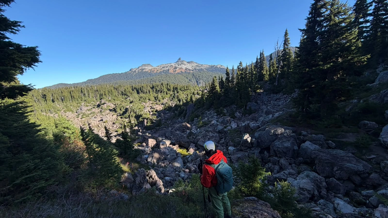
The boulders kept coming: several smaller fields, a much larger one and a drainage chute filled with more broken rock. Even the meadow sections did not always make navigation easier. Overgrown vegetation concealed the line, and blind corners gave us little view of what lay ahead.
I kept calling, “Hey bear,” because I did not want to surprise an animal or come between an adult and a cub. We did not see a bear or cub. The poor visibility was what kept that possibility in mind; it did not tell us which species, if any, were nearby.
We had not seen anyone else on the Mount Price approach beyond the lake. Physically, I felt encouraged. It is a demanding route, yet I could feel my fitness returning and was moving comfortably on the ascent. The constant attention to the surroundings, and the repeated calls through the brush, took their own energy.
Loose scree, needle ice and the first slip
After the chute, Price and Clinker came into clear view. We decided to head toward Mount Price first. The climbing led onto loose scree, where the surface was difficult to read. Some patches appeared firm; elsewhere, fragments moved readily underfoot.
I suspected that recent snow had become wet or melted, then frozen overnight. That was my interpretation of the conditions. The photograph below shows a more specific feature: columns of ground ice lifting soil, consistent with needle ice.
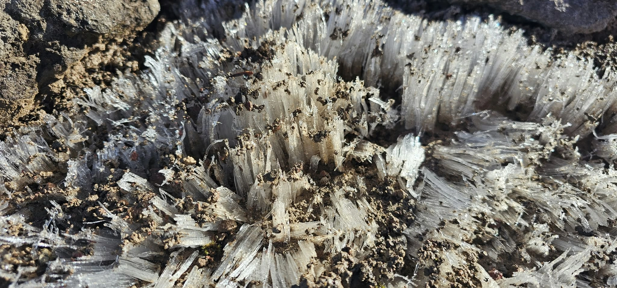
Needle ice grows as moisture moves through the soil toward a freezing surface. The growing columns can push sediment upward; thawing then leaves the disturbed surface exposed. Our photograph illustrates the formation, although it cannot establish the exact overnight temperature or the full sequence of the recent weather. A Virginia Tech study of freeze–thaw processes discusses this behaviour.
While trying to find a line, I stepped and slipped. Both feet went out from under me. I recovered and continued, but the footing was extremely slippery. I relied on my poles as we worked higher, moving between frost-held rocks and much looser material.
A frozen snowfield below the Price–Clinker col
We continued beneath Clinker toward the col between the two peaks and came to a snowfield. It was firmly frozen when I tested it with my hiking pole. The concern was the runout: a slip could carry us toward a large boulder below, and we had no ice axe with us.
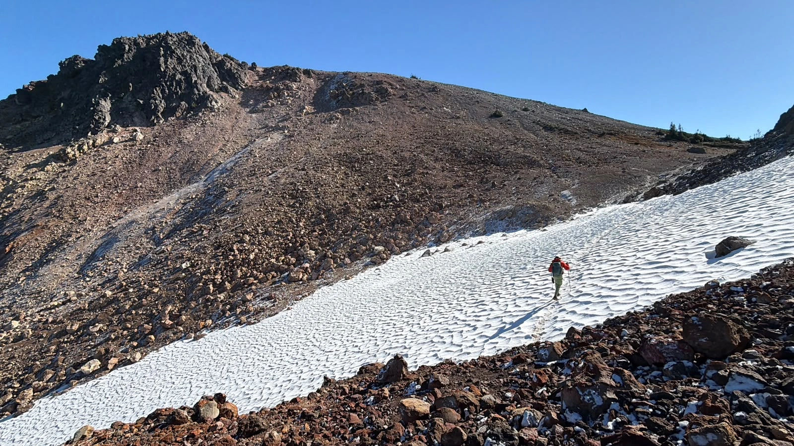
We could have gone around. I chose to cross because I wanted to avoid the extra walking, and we did not put on our spikes. We moved slowly and carefully and reached the other side. The GPX records that choice; it is not a recommendation to repeat it on hard snow. Poles and careful steps do not remove the consequence of a fall into rocks.
Mount Price summit: The Table, Garibaldi and lunch above the lake
Beyond the snowfield, the view opened to The Table and Mount Garibaldi. The Table’s shape brought back a memory of a music video we had seen. Whistler Museum identifies it as the setting for Glass Tiger’s I Will Be There, filmed in 1986.
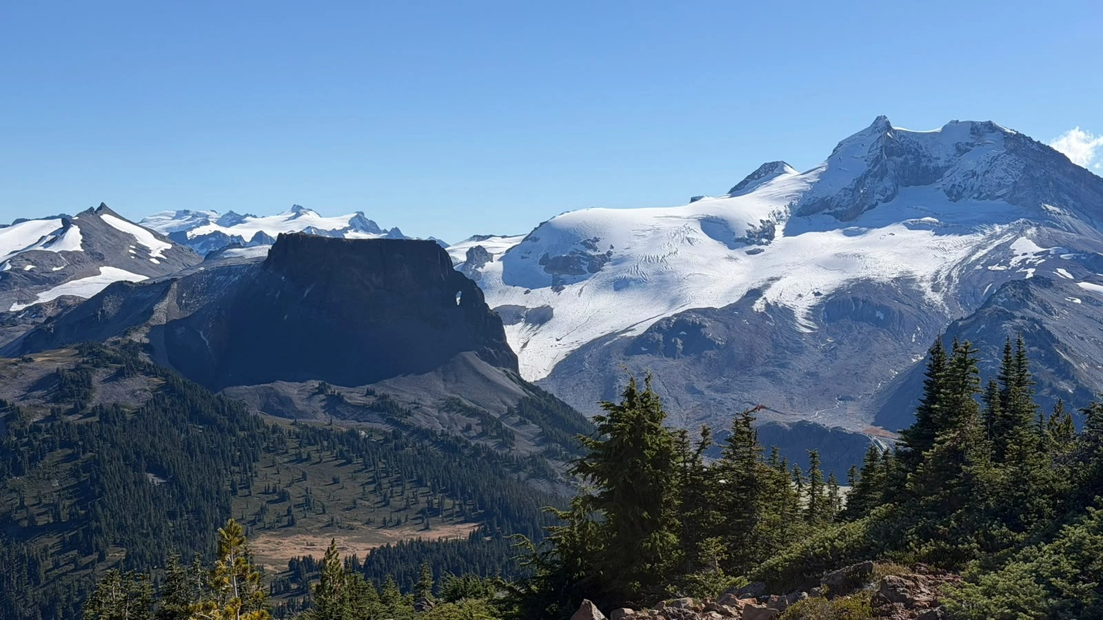
Just below Price’s summit ridge—perhaps fifty metres below the top—I slipped again. Both feet went out from under me while I was standing. I used my hands to stop myself and ended up with them covered in mud. After getting settled, I drank more and used some of my extra water to wash my hands.
The final approach crossed red scree that had become muddy as the frozen ground thawed. We reached the summit and looked across Garibaldi Lake toward Black Tusk, Panorama Ridge and the mountains beyond. We took photographs and had lunch in the sunshine.
Our track reaches the upper summit area at approximately 12:40 p.m. The highest recorded point is 2,050.2 metres at 12:50 p.m. We were moving and stopping around the upper area until roughly 1:19 p.m.; that window is not a precise measure of the lunch break.
I was conscious of what the sun could do to the ground we had just climbed. Staying longer might mean more thawing and even less reliable footing on the way back. We decided against a long stay, with Clinker and the return through the boulder fields still ahead.
Two runners and a brief misunderstanding
Coming off Price was very slippery. On the descent we met two runners, and the encounter briefly startled both groups. They thought we were bears; we thought they were bears. Once we realised who was coming toward us, the moment became funny. They helped take a photograph of us, and we took one for them. Apart from those two runners, we did not see anyone else on the mountain route that day.
Clinker’s ridge and the 1,993-metre reading
We descended to the col, then climbed toward Clinker’s ridge. We went left first, to a point I thought might be the highest part, but did not traverse the entire ridge. I also went right and climbed onto a rock.
My Garmin Solar watch showed about 1,993 metres. The GPX independently contains a 1,992.8-metre reading at 1:38:26 p.m. in the area we visited, which rounds to the number I remembered. That is a recorded elevation, rather than proof of a surveyed summit position.
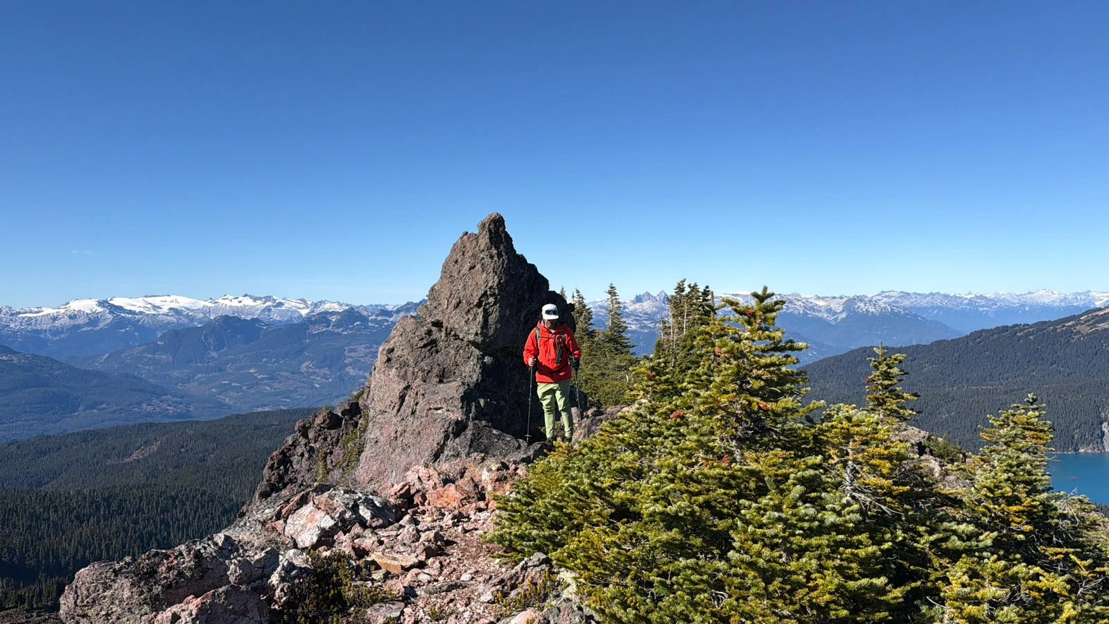
I did not take a photograph while standing on that rock. After climbing down, we took a photograph from the ridge and began retracing our route.
The descent: thawing ground, more slips and a difficult return through the bush
We crossed the snowfield again and worked down the line we had climbed. Recognising the general direction did not make the return easy. The ground had thawed further, and loose rock and mud were extremely slippery. I slipped several more times.
Around this part of the descent, I lost a glove after removing it to take a photograph. I did not climb back to search: we were losing daylight, and I wanted to save our energy for the return. Farther down, among the boulders, I left the matching glove on a rock, hoping that someone who found one might also find the other.
We reached the meadows and boulder fields, but picking out the route remained difficult. There were many dark cavities between the rocks. I wondered whether animals might use them, but saw none and had no evidence to identify those spaces as dens. We continued calling “Hey bear” through the brush and blind corners. Keeping that up while concentrating on the route and footing became exhausting.
Reaching Garibaldi Lake did not immediately end the navigation. We came toward the shore, went into the bush and uphill again, then returned to the lake. We walked around the lakeshore while recovering the line back. By then, we were very tired. We stopped briefly, took electrolytes and continued down the established trail.
The recording finished near the Rubble Creek parking area at 6:10 p.m. The complete outing had taken just over eleven hours.
Despite the difficult return, I enjoyed the hike. For me, Mount Price offered one of the best outlooks I have seen in Garibaldi Park. Black Tusk and Panorama Ridge are famous destinations; Price gave us a quieter perspective on the same landscape. The summit view was the reward, but the brush, boulders and changing footing defined the day just as much.
How long did our Mount Price and Clinker outing take?
The GPS timestamps cover 11 hr 16 min 18 sec. That includes stops, photographs, lunch, route-finding and backtracking. The following stages use the recorded upper-elevation windows to separate the two summit-area visits.
| Stage | Time, PDT | Recorded duration |
|---|---|---|
| Start to Mount Price upper summit area | 6:54:01 a.m.–12:39:41 p.m. | 5 hr 45 min 40 sec, including pauses |
| Mount Price upper area | 12:39:41–1:18:57 p.m. | 39 min 16 sec, including movement and stops |
| Price upper area to Clinker upper ridge | 1:18:57–1:35:08 p.m. | 16 min 11 sec |
| Clinker upper ridge | 1:35:08–1:45:47 p.m. | 10 min 39 sec, including movement and stops |
| Clinker upper ridge to recording finish | 1:45:47–6:10:19 p.m. | 4 hr 24 min 32 sec, including pauses |
| Complete outing | 6:54:01 a.m.–6:10:19 p.m. | 11 hr 16 min 18 sec |
The Price upper-area window uses the continuous visit at or above approximately 2,035 m GPS elevation; the Clinker window uses the visit at or above approximately 1,980 m. These are practical analysis boundaries, not exact moments of reaching a surveyed summit or sitting down for lunch.
GPX figures, Strava time and breaks
The original GPX contains 14,057 points in one track segment. Summing the horizontal distances between those points gives 30.36 km; summing all positive elevation changes without smoothing gives approximately 1,994 m. Strava’s verified public embed shows 30.3 km, 1,778 m and 9 hr 4 min under the label “Time.”
The difference between that displayed time and the complete GPS span is 2 hr 12 min 18 sec. The public embed does not explicitly label its figure as moving or elapsed time, so the difference should not be presented as an exact total of rest breaks. Separate ascent and descent times excluding every pause cannot be verified from the supplied summaries.
The whole-recording average is approximately 2.69 km/h, including all stops and detours. That is a description of this outing, not a comparison with an ordinary maintained trail or a medical measure of fitness.
Our Strava activity
Open the Mount Price and Clinker Peak activity on Strava .
GPX map: our complete recorded route
The map loads the original GPX from the ZIP and draws every recorded point, including the lakeshore detours and both upper-mountain visits. The download remains the record of what we did that day.
Read the route with the story. It includes uncertain route-finding and a frozen-snow crossing that carried a serious fall consequence. Terrain, snow hardness and access can change; the line is not a guarantee of a suitable route.
Loading the recorded route. The original ZIP download is available below.
Preparing the GPX map.
Recorded elevation profile
Trailhead area and upper-route coordinates
| Recorded location | Latitude, longitude | What it represents |
|---|---|---|
| Rubble Creek access-area start | 49.957797, −123.119384 | First GPX sample, 6:54:01 a.m.; not a separately surveyed parked-car position. |
| Recorded finish near parking | 49.957543, −123.120393 | Final GPX sample, 6:10:19 p.m. |
| Mount Price GPS high point | 49.917831, −123.035355 | 2,050.2 m at 12:50 p.m.; highest recorded point. |
| Clinker ridge GPS high point | 49.915496, −123.040517 | 1,992.8 m at 1:38:26 p.m.; high point of the ridge excursion we recorded. |
The map also includes BC Geographical Names reference positions for Mount Price, Clinker Peak, Black Tusk, Panorama Ridge, The Table and Mount Garibaldi. Those published positions describe approximate feature centres. The Clinker reference lies about 250 m from our recorded high point; neither that reference nor the watch elevation alone proves the exact surveyed summit location.
Rubble Creek trailhead directions and seasonal access
From Vancouver: follow Highway 99 north through Squamish toward Whistler. BC Parks places the Rubble Creek turnoff approximately 37 km north of Squamish, just after the Rubble Creek bridge when travelling north. Turn right onto the paved access road and follow it approximately 2.5 km to the Garibaldi Lake parking area.
From Abbotsford or Chilliwack: take Highway 1 west toward West Vancouver, connect to Highway 99 north and continue through Squamish to the same Rubble Creek access road. Use current navigation for traffic and road junctions. From Whistler, the turnoff is approximately 19 km south.
For our October 11, 2026 visit, Rubble Creek fell within BC Parks’ published day-use vehicle-pass season: Friday through Monday and holidays, June 12–October 12, 2026. Check the current pass rules and Garibaldi Park advisories for the date of your own outing.
BC Parks notes limited reception and that the Rubble Creek road is not ploughed to the parking lot in winter. Check road access and mountain conditions separately when planning a later-season visit.
More Garibaldi trip reports
Sources and recording notes
Personal observations and the six photographs are from our October 11 outing. Distances and timeline calculations use the supplied original GPX; Strava figures were checked against its public embed.
- BC Parks: Rubble Creek/Garibaldi Lake access
- BC Parks: Garibaldi advisories and Taylor Meadows notice
- BC Parks: 2026 day-use pass dates
- Mount Price and Clinker Peak, BC Geographical Names
- Black Tusk, Panorama Ridge, The Table and Mount Garibaldi, BC Geographical Names
- Whistler Museum: The Table and Glass Tiger’s 1986 video
- Virginia Tech: needle ice and freeze–thaw processes