This was supposed to be another big alpine day. Mount Price was on the list, then Three Brothers became the plan: run the three summits, possibly continue to Fourth Brother, and look back across the full traverse. Before we began the drive, one partner felt unwell. The delay cost us October daylight, so we shortened the drive and changed the objective to Baker Rock via the Super Sumas Grind on Sumas Mountain.
It was a smaller mountain, but not a casual substitute. Also called the Sumas Super Grind or Baker’s Grind, this route is commonly listed at roughly a 47% average grade, includes about 13 fixed-rope assists, a wooden ladder and a steep descent that demands more care than the ascent. I jokingly called it “the K2 of Abbotsford”—not a literal comparison, just an acknowledgment that a short local mountain can still be serious.
Our October 7 recording reached the Sumas Mountain summit/Eastern Lookout, continued to the Baker Rock viewpoint area and returned the same way. Strava reports 5.6 kilometres, 936 metres of elevation gain and 2 hours 48 minutes of moving time. The complete GPX contains 5.81 kilometres of track and 4:07:37 from the first recorded point to the last.
Baker Rock via Super Sumas Grind statistics
Distance, elevation gain and moving time can differ between the original recording, a downloaded GPX and Strava because each platform smooths track points, filters elevation and handles stopped time differently. A 47% grade is not a 47-degree slope: it corresponds to an average angle of about 25°, although individual rock and dirt steps can be much steeper.
From Three Brothers to the Super Sumas Grind
Everything was ready for a bigger alpine objective. We first considered Mount Price, then settled on Three Brothers and hoped to run all three summits, perhaps touching Fourth Brother before turning back. When one partner felt sick before the drive, we waited. By the time the plan could move again, the usable October daylight was shrinking.
Instead of forcing a long drive and a late alpine start, we cut the objective down to Sumas Mountain. The Super Sumas Grind was new to us as a complete route, close enough for the remaining window and steep enough to preserve the training value of the day.
We reached the trailhead around 1:00 p.m. and the GPS began recording at 1:30 p.m. There was nobody else on the mountain. Because my partner was still not feeling well, speed was never the priority. A group moves at the pace of its slowest hiker; beginning too fast would only have made a steep route worse later.
Short does not mean beginner-friendly
The climb did not feel as bad to us as the numbers suggested, and I would call it moderate for a serious mountaineer moving carefully. That is a personal assessment, not a beginner rating. The sustained grade, loose autumn surface, rope-assisted steps and consequential descent make this an inappropriate first hike for an inexperienced person.
Super Sumas Grind map and exact recorded GPX
This is the actual Strava activity from our October 7 hike—not a decorative or invented route graphic. It displays the mapped track together with Strava’s real ascent and descent profile. The GPX download immediately beneath the map is the route recorded during the outing from the lower trailhead to the Sumas Mountain summit, beyond to Baker Rock and back.
Our recorded route—not a line copied from an app
Many tracks downloaded from hiking apps are simplified, hand-drawn, copied from another person or shifted when transferred between platforms. This file follows where our Garmin-recorded activity actually travelled, including the summit, the Baker Rock extension and the return. Small bends and overlaps are part of the real recording.
No consumer GPS is survey-grade. Tree cover can shift positions, obstacles and informal trails change, and a battery can fail. Save the file offline, carry a second navigation method and keep matching the electronic line to the terrain in front of you.
Recorded trailhead, Sumas summit and Baker Rock data
The summit and Eastern Lookout occupy nearly the same mapped high area. Our first summit crossing came just after 3:32 p.m. We then descended north to the Baker Rock viewpoint area, reached the northernmost point in our track around 3:47 p.m., made a small loop through the viewpoint area and recrossed the summit shortly before 3:54 p.m. on the return.
| Recorded point | Local time | Elapsed | Track distance | Elevation / note |
|---|---|---|---|---|
| Lower trailhead start | 1:30:21 p.m. | 0:00:00 | 0.00 km | GPS recording begins |
| Sumas summit / Eastern Lookout | 3:32:27 p.m. | 2:02:06 | 2.57 km | 899.8 m recorded |
| Baker Rock / northernmost track point | 3:47:25 p.m. | 2:17:04 | 2.86 km | 881.0 m recorded; approximately 23 m from the mapped Baker Rock point |
| Summit recrossing / GPS high point | 3:53:41 p.m. | 2:23:20 | 3.10 km | 903.6 m recorded |
| Trailhead finish | 5:37:58 p.m. | 4:07:37 | 5.81 km | Recording ends about 11 m from the starting point |
Coordinates are six-decimal track positions from the supplied GPX. The Baker Rock point is an informal viewpoint feature rather than a surveyed summit marker; the coordinate shown is the closest point reached by our recording to the commonly mapped feature.
Quarter markers, hidden footing and an autumn ascent
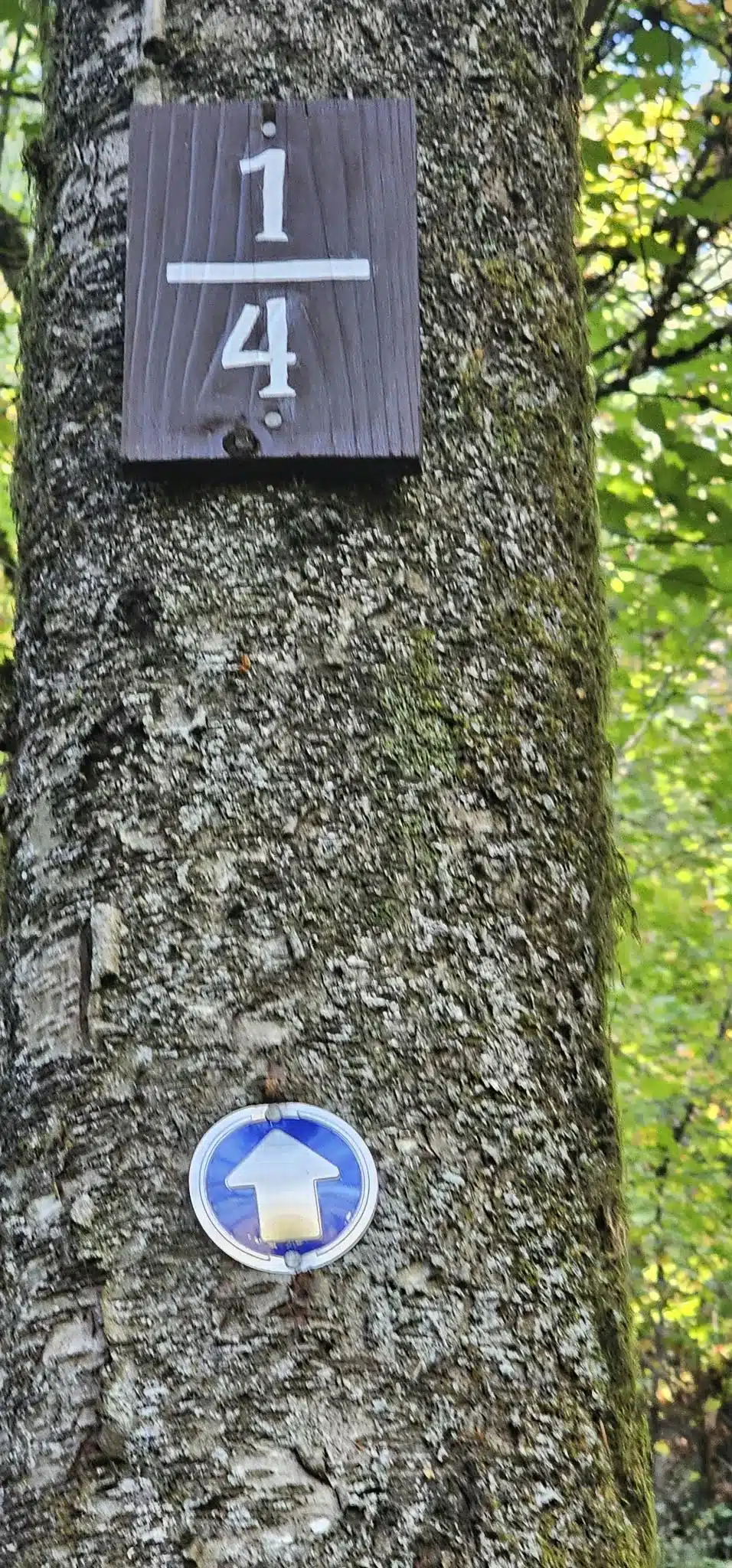
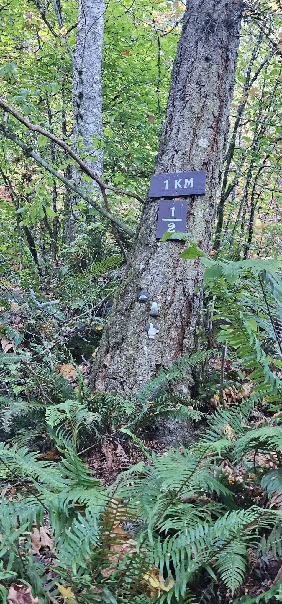
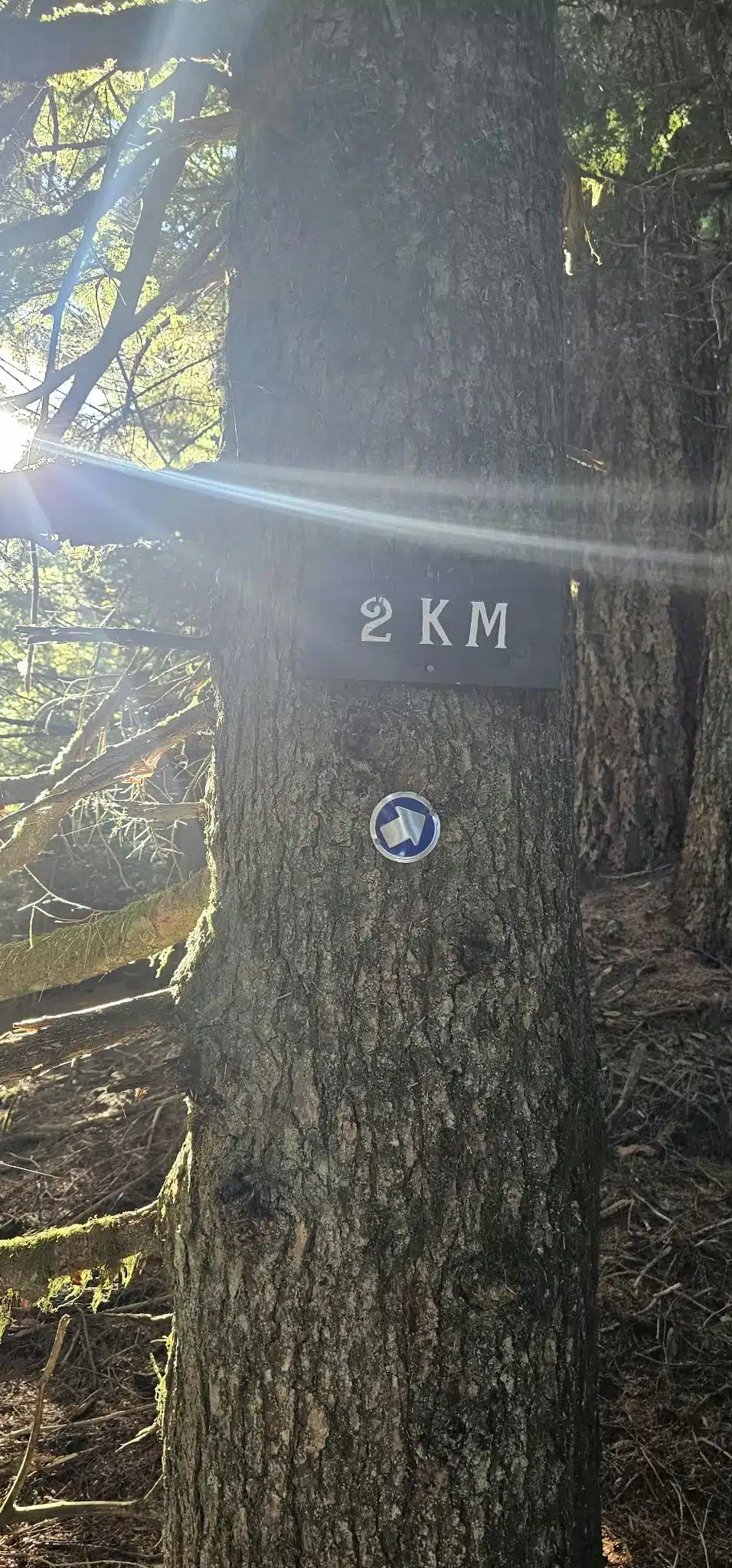
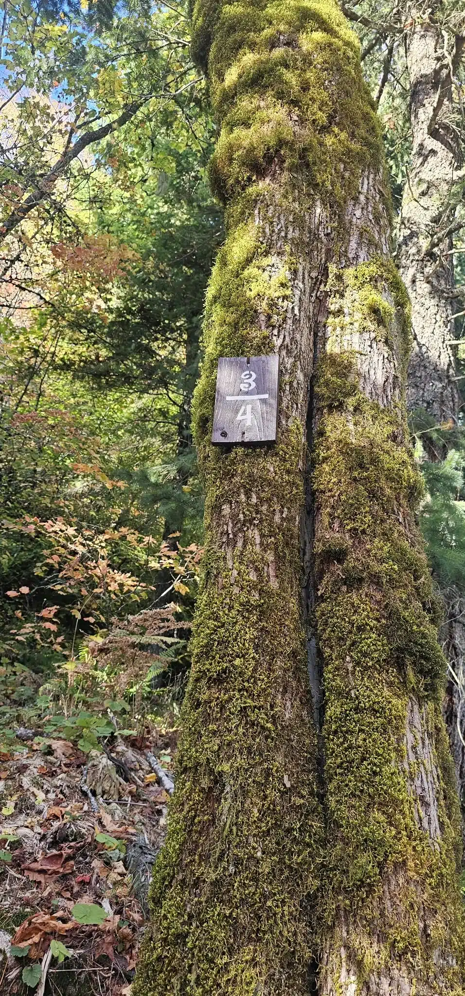
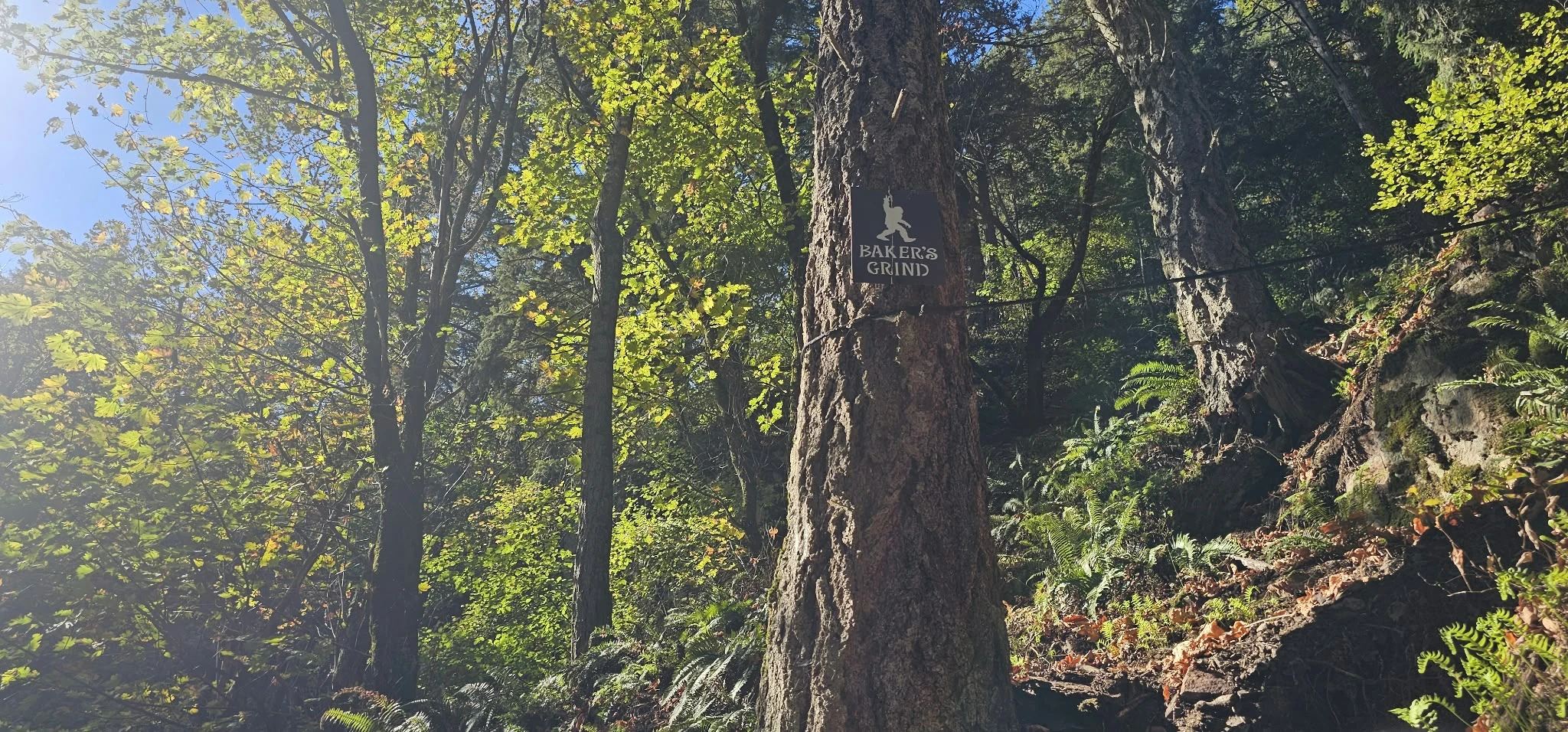
From the beginning, the route wastes little time. Quarter markers fixed to trees make progress easy to understand, and the blue route discs keep the general line obvious. The first established viewpoint has a long bench; beyond it, the route remained impressively well marked. Whoever marked and worked on this trail did an excellent job. The route felt unusually clear for such steep forest terrain.
October changed the surface. Fallen leaves hid rocks, roots and pine cones. Pine cones acted like ball bearings underfoot, while loose material covered the exact place where a boot needed to land. Wet leaves and roots would make the route worse; an extremely dry day can also leave dust, soil and debris loose. This is not a route I would choose in rain, immediately after heavy rain, during ice, or when the tread is powder-dry and unstable.
About 13 rope sections and a fixed ladder
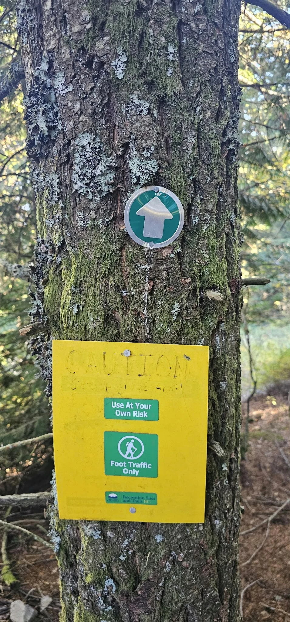
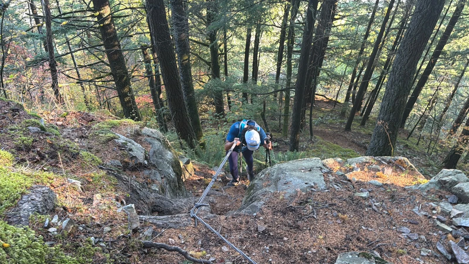
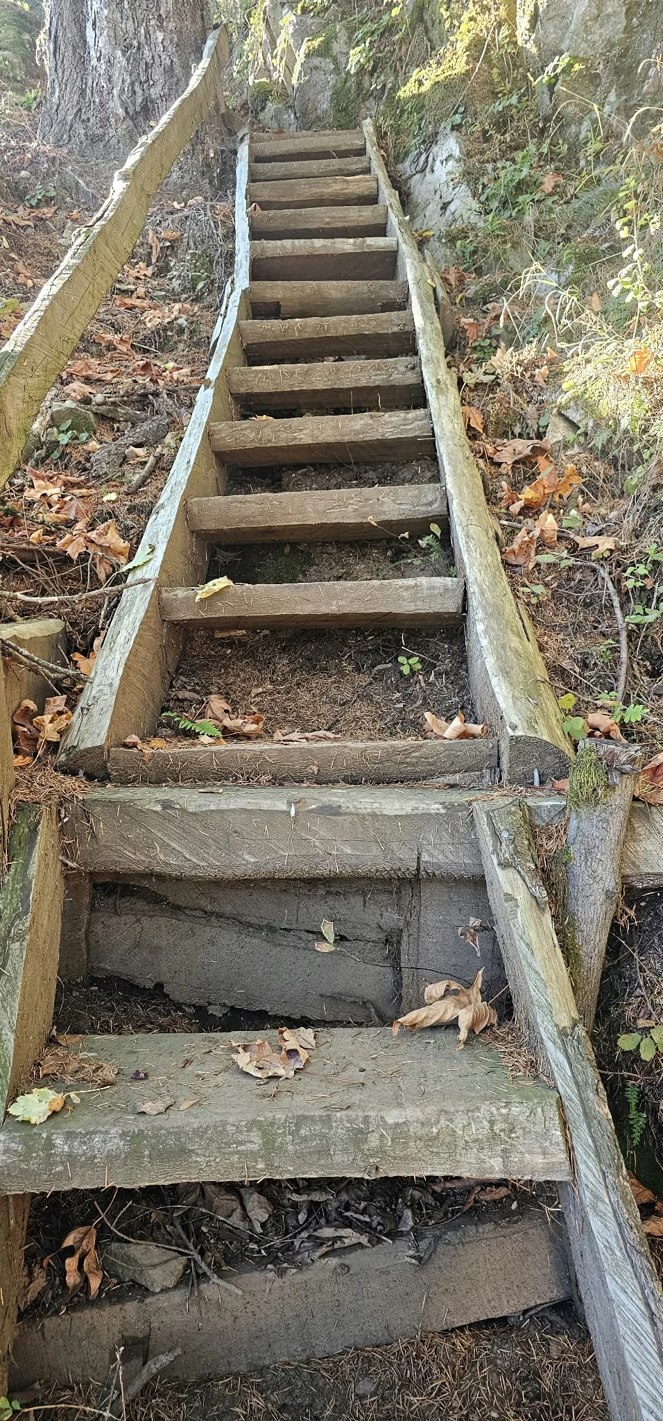
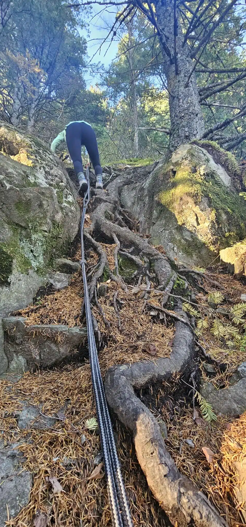
We counted approximately 13 rope-assisted sections during our outing. They are useful on the ascent and even more valuable when downclimbing. A fixed wooden ladder breaks up one of the steeper forest steps. The aids do not turn the route into a protected climb; they simply help movement on very steep ground.
Fixed ropes are not certified protection
Inspect every rope, knot and anchor before use. Do not blindly put full body weight on an unknown line, and never assume volunteer-installed equipment is inspected to a climbing standard. Keep three points of contact, avoid standing beneath another hiker, and stow trekking poles before using both hands. If the rope, anchor, rock or roots look unsafe, turn around.
From Sumas Mountain summit to Baker Rock—and fresh bear sign
Just before the summit, the forest becomes overgrown enough that an animal could be close without being visible. The track reached the summit/Eastern Lookout area at 3:32 p.m. From there we descended toward the more open Baker Rock viewpoint rather than stopping at the treed high point.
Near a damp, needle-covered section between the summit and the viewpoint, we found what appeared to be a black bear paw print and fresh digging. We had been talking and making noise throughout the climb, and I suspected a bear may have left the area after hearing us approach. That is only an inference: we did not see a bear or any other animal, and one print cannot tell us whether the animal was still nearby, how recently it passed, or whether it had cubs.
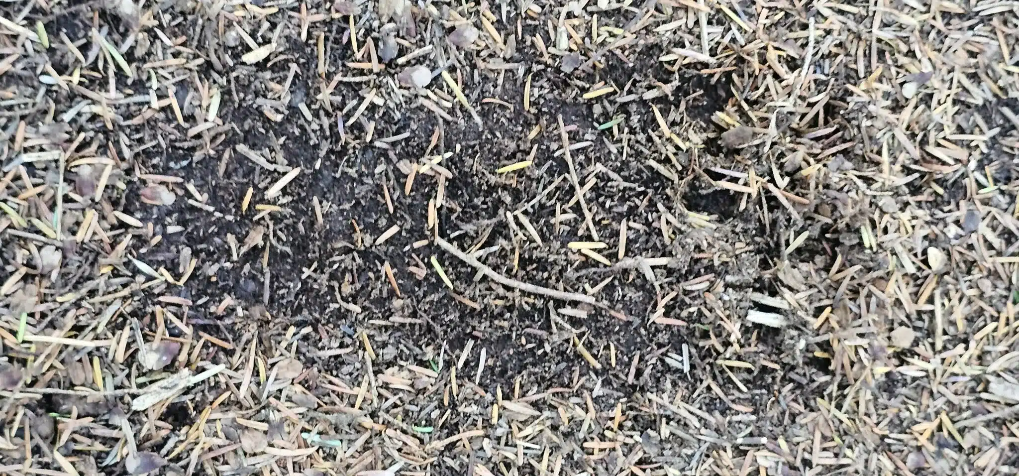
October is an important feeding period for bears. During fall hyperphagia, black bears eat intensively in preparation for winter. With nobody else on the mountain, diminishing light and bear sign near the viewpoint, we chose the known route back rather than trying to complete the longer Centennial Trail loop.
What can you see from Sumas Mountain and Baker Rock?
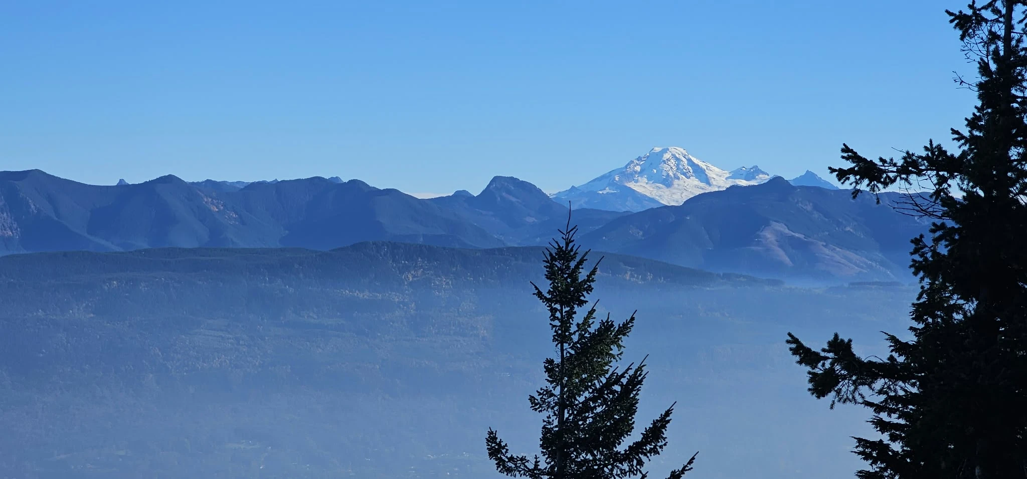
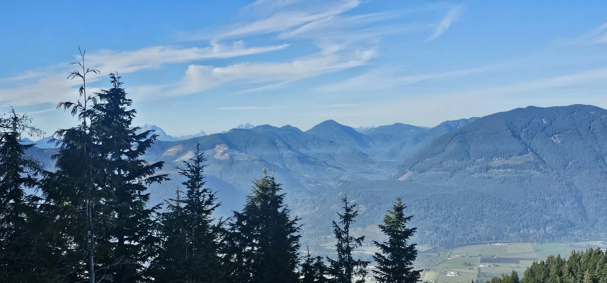
The open viewpoints make the steep approach worthwhile. Mount Baker dominates the south-southeast skyline. To the northwest are Golden Ears and Evans Peak and the remote Mount Robie Reid–Mount Judge Howay group, with The Defendant and The Witness in the same rugged judicially named cluster. East and northeast, the view opens across the Cheam Range and toward the distant Coquihalla corridor explored on our Needle Peak and Yak Peak outings. Below are Chilliwack, Highway 1, the Fraser River channels and the Fraser Valley farmland.
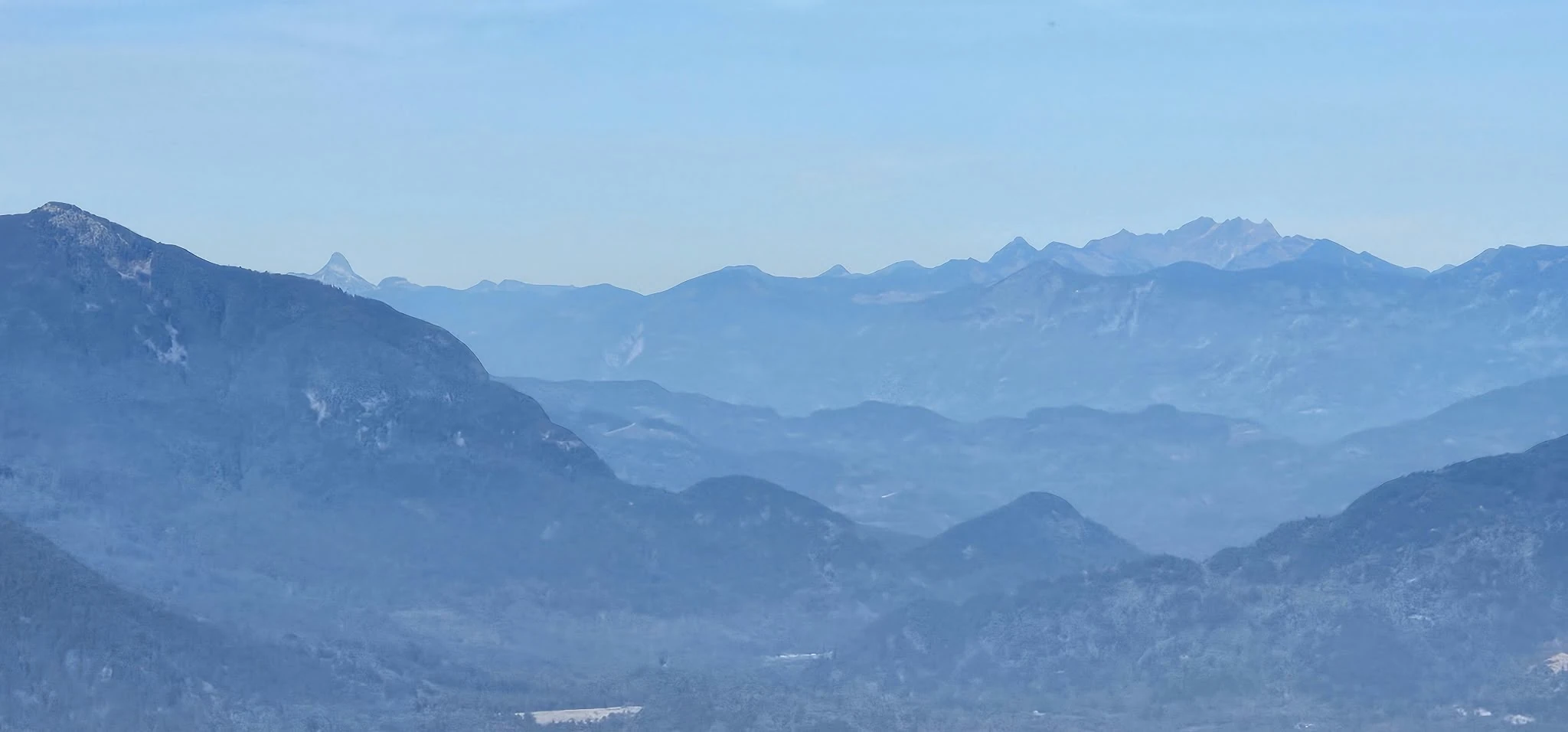
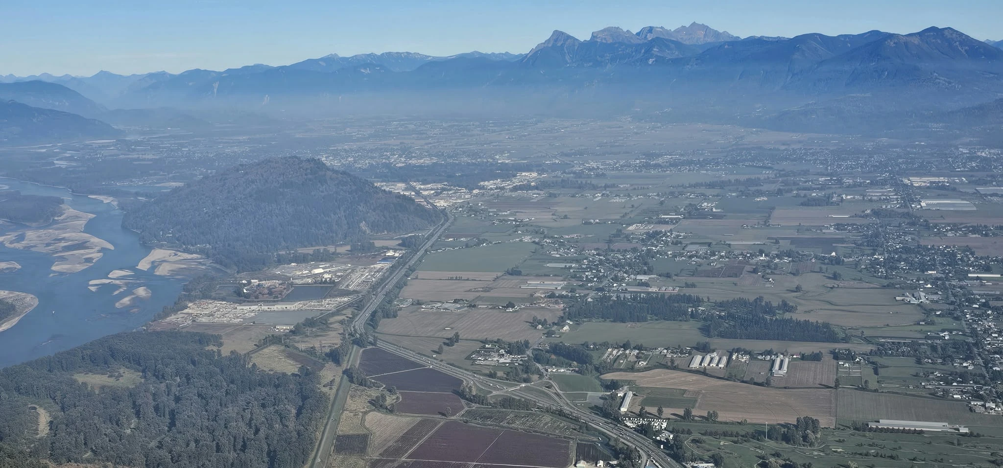
| Landmark | Approximate bearing from summit | Direction | Relationship to the route |
|---|---|---|---|
| Mount Baker | 149° | South-southeast | Dominant snow-covered volcano in the Baker Rock panorama |
| Taggart Peak | 211° | South-southwest | About 2 km away; more accurately SSW than due west |
| Golden Ears | Approximately 315° | Northwest | Part of the broad Coast Mountains skyline |
| Mount Robie Reid | 334° | North-northwest | Remote peak in the Golden Ears region |
| Mount Judge Howay | 342° | North-northwest | Distinctive remote massif beyond the valley |
| Mount Cheam | 77° | East-northeast | Above the Chilliwack side of the Fraser Valley |
| Needle Peak / Yak Peak corridor | Approximately 54–55° | Northeast | Distant Coquihalla direction; individual peaks depend on clarity and exact viewpoint |
The loop could wait; daylight and known terrain mattered more
We had considered descending through the Centennial Trail to make a loop. Three things argued against it: daylight was diminishing, we did not want to begin route-finding on an unfamiliar descent, and the bear sign made an isolated late-day extension less appealing. Retracing the exact line we had just climbed was the simpler and safer decision.
There was also history behind that choice. A few years ago we tried the regular Sumas Mountain hiking route and ended up route-finding onto a mountain-bike trail near Chadsey Lake. We will probably return to complete the standard route as an exercise day, but this was not the evening to repeat that experience.
Trekking poles were extremely useful on the descent, although they should be stowed for rope and ladder sections. We did not run. Leaves concealed the footing, loose pine cones could roll, and a preventable fall would have turned a compact workout into a serious problem. We finished at 5:37 p.m., with the GPX ending only about 11 metres from its starting point.
Super Sumas Grind safety, gear and conditions
- Bring the correct offline GPX. Do not rely on a generic app route, a cellular signal or one device.
- Carry bear spray accessibly. Make noise in dense vegetation and know how to respond before an encounter.
- Use trekking poles intelligently. They help on loose descent terrain; stow them where ropes require both hands.
- Carry a headlamp. Autumn daylight disappears quickly, especially beneath dense forest.
- Bring enough water and food. A short horizontal distance does not reduce the work of gaining roughly 900 m.
- Check every rope and anchor. Treat each handline as an unverified aid, not certified protection.
- Avoid poor surfaces. Rain, ice, wet leaves and extremely dry loose tread all increase the descent risk.
- Turn around early when needed. Illness, unstable footing, fading light or wildlife activity are valid reasons.
- Check current park information. Hours, access, closures, road conditions and trail conditions can change.
- Leave the route as found. Pack out food and waste and do not disturb wildlife or informal trail equipment.
Good steep-training terrain—with limits
With a pack, poles and careful pacing, this route can be useful preparation for larger climbs because it trains calves, sustained uphill movement and controlled downclimbing. It is not a substitute for Himalayan altitude, exposure, weather, acclimatization or technical mountaineering skill.
I highly recommend the Super Sumas Grind to experienced hikers who want a close-to-home challenge and who arrive prepared for the descent. The neighbouring Abby Grind approach on our Taggart Peak hike felt relatively easy beside this much steeper, rope-assisted line.
To the people who marked and maintained this route: the work is excellent. If you can verify that you are part of the trail crew, please contact me. I would like to contribute toward an appropriate replacement rope or other approved maintenance materials—not install equipment independently.
Frequently asked questions
How long is the Super Sumas Grind to Baker Rock?
Strava reports 5.6 km for our out-and-back activity. A point-by-point calculation of the supplied GPX is approximately 5.81 km, including the summit and Baker Rock extension.
How much elevation gain did this Baker Rock route have?
Strava reports 936 m of elevation gain. Our highest recorded GPS elevation was 903.6 m near the summit on the return.
How long did the Super Sumas Grind take?
Our recording ran from 1:30:21 p.m. to 5:37:58 p.m., a total elapsed time of 4:07:37. Strava displays 2:48 of moving time.
Is the Super Sumas Grind really a 47% grade?
We describe the sustained Baker’s Grind ascent as approximately 47–48% average grade. A 47% grade equals roughly a 25° average slope, not 47°. Individual steps can be substantially steeper.
How many rope sections are on Baker’s Grind?
We counted approximately 13 rope-assisted sections, plus a fixed wooden ladder. The exact number can depend on what is counted as a separate section and can change if volunteer equipment is moved or removed.
Is Super Sumas Grind suitable for beginners?
I do not recommend it as a beginner route. It is short but extremely steep, includes rope-assisted downclimbing, and can have loose rocks, roots, leaves and pine cones underfoot.
Can I hike the Super Sumas Grind when it is raining?
Wet roots, rock and leaves can make both climbing and downclimbing dangerous. Ice and extremely dry loose tread are also poor conditions. Choose a stable, dry day and turn around if traction is unreliable.
Where does the recorded route start?
Our GPX begins at 49.114038, -122.114407 on the lower east side of Sumas Mountain. Confirm legal parking, access and current conditions before leaving home.
What are the Sumas Mountain summit coordinates?
Our first summit/Eastern Lookout track point was 49.120614, -122.127474 at 3:32:27 p.m. PDT, 2.57 km into the recording.
Where is Baker Rock?
Our northern Baker Rock approach reached 49.121893, -122.126737 at 3:47:25 p.m. The point is approximately 23 m from the commonly mapped Baker Rock feature.
Is this a real recorded GPX?
Yes. The download contains the actual route from our October 7, 2026 outing, recorded from the lower trailhead through the Sumas summit and Baker Rock extension and back to the start. Consumer GPS remains approximate and does not replace route judgment.
What mountains can you see from Baker Rock?
Clear-day views include Mount Baker, the Cheam Range, Golden Ears, Mount Robie Reid and Mount Judge Howay. The Defendant, The Witness and the distant Coquihalla corridor lie in the wider skyline, while Chilliwack, Highway 1 and Fraser River channels spread across the valley below.
Why did you return by the same route instead of making a Centennial Trail loop?
We retraced the Super Sumas Grind because daylight was fading, the loop was unfamiliar and we had found bear sign near the summit extension. The known descent was the more conservative choice.
- Fraser Valley Regional District — Sumas Mountain Regional Park information and current park hours
- BC Geographical Names — official Sumas Mountain record
- WildSafeBC — black bear biology, fall hyperphagia and safety information
- Our Strava activity 20496515277 — recorded route, processed distance, elevation gain and moving time