Evans Peak was never the original objective. We had been considering Coquihalla Mountain—possibly during one of the final practical weeks before snow made the trailhead difficult to reach—or Mount Price. Neither plan came together, and the day changed direction at the last minute toward Golden Ears Provincial Park.
We had stood at this trailhead four or five years earlier, yet it took that long to return and complete the Evans Peak hike. We started in the afternoon, kept the ascent deliberately relaxed and did not try to run. The route is not especially long, but its roots, steep rock steps and fixed handlines make careless speed unnecessary—particularly on the descent.
Our actual October 4, 2026 recording covered 10.69 kilometres with approximately 990 metres of cumulative ascent. This report includes the exact GPX, summit coordinates, a real Strava map and elevation profile, the two rope-assisted sections, the optional ridge extension, mountain identifications and the history behind the Evans memorial plaque.
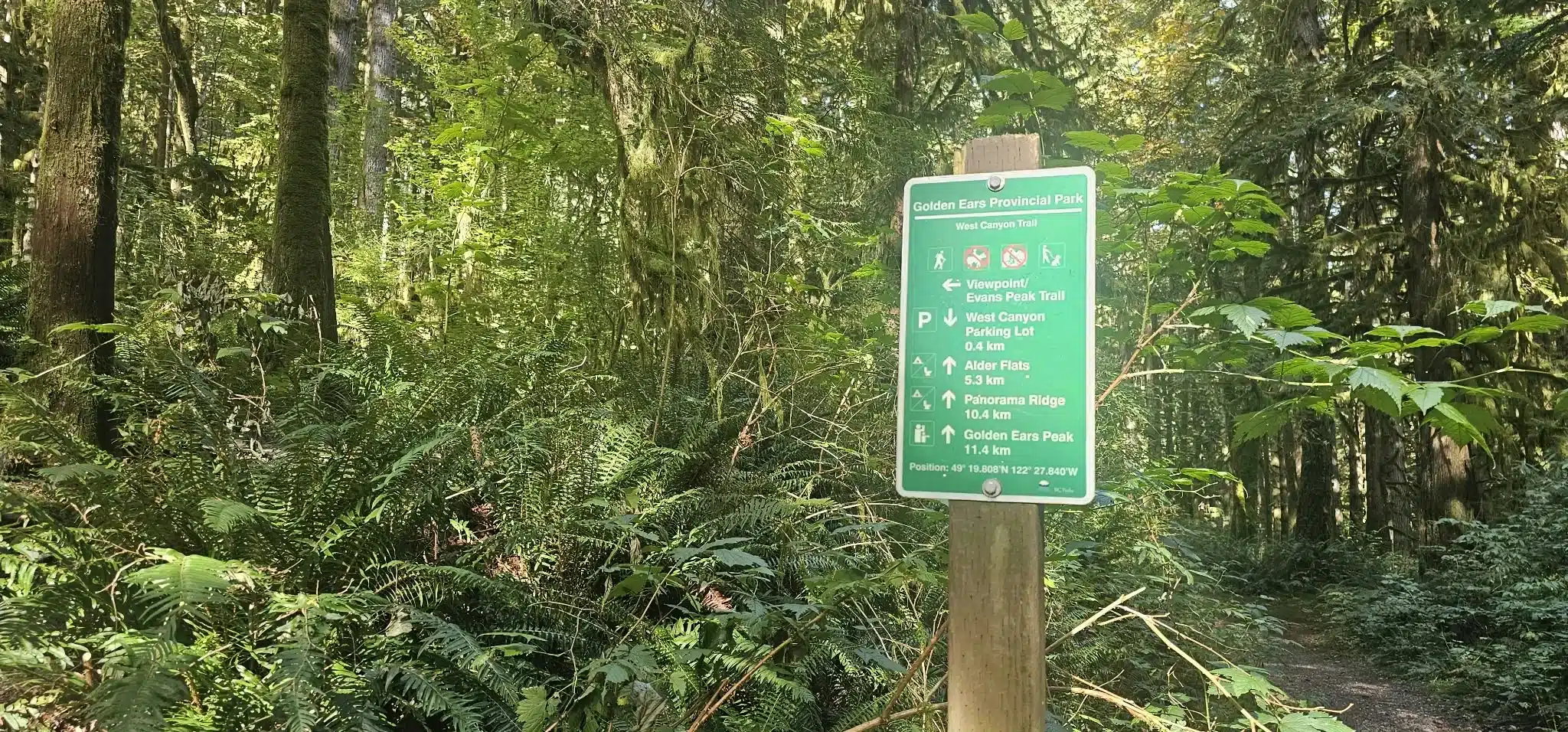
Evans Peak hiking statistics
These measurements come from our complete watch-recorded GPX. Strava displays 10.5 km, 991 m of gain and 4:10 for the processed activity. GPS platforms smooth elevation and calculate stopped or moving time differently, so modest differences are normal.
Evans Peak was never the original plan
The goal that Sunday morning was not Evans Peak. We had been considering Coquihalla Mountain—possibly during one of the final practical weeks before snow made the trailhead difficult to reach—or Mount Price. Neither plan came together, and the day pivoted at the last minute toward Golden Ears Provincial Park.
We had stood at this trailhead four or five years earlier, yet somehow it had taken that long to return and finish the Evans Peak hike. We began in the afternoon and deliberately kept the climb easy. We did not stop for long breaks; we simply moved without spending unnecessary energy and enjoyed being back in the forest.
This was also not a day to run. Evans Peak may feel relatively manageable to an experienced hiker at a relaxed pace, but its steep root lattice, rock steps and handline sections punish careless footing. Coming downhill, especially, there was no reason to take that risk.
“Relatively easy” needs context
The outing felt quite doable to us when taken slowly, but Evans Peak is not a beginner-easy walking trail. The objective hazards—steep ground, polished roots, slippery rock, two rope-assisted steps and some route-finding—remain. In rain, or immediately after it, the same route can become substantially harder.
Evans Peak map and exact recorded GPX
This is the real Strava activity from our hike—not a decorative elevation graphic. It shows the mapped route and the true ascent/descent profile generated from the activity. The downloadable GPX beneath it is the track recorded during this outing, including the summit and our short extension beyond it.
Recorded route—not a route sketched from another app
Many downloadable tracks are copied, simplified or drawn by hand, and can miss the trail when opened on a different device. This file contains our actual watch recording from the West Canyon parking area to Evans Peak, through the summit and briefly beyond it, then back to the start. Its small bends include the way we genuinely travelled.
No consumer GPS is survey-grade, and a GPX cannot replace judgment. Tree cover can shift a position, trails and obstacles change, and batteries fail. Carry the route offline, watch the terrain, and be ready to turn around.
Recorded Evans Peak route data
The statistics below come from the supplied GPX. Strava displays 10.5 km, 991 m of gain and 4:10 for the processed activity; the raw GPX contains 10.69 km and 5:31:44 from the first recorded point to the last. GPS platforms smooth elevation and calculate stopped or moving time differently, so modest differences are normal.
| Point | Recorded time | Elapsed | Track distance | Note |
|---|---|---|---|---|
| West Canyon start | 12:23:02 p.m. | 0:00 | 0.00 km | Afternoon departure |
| Evans Peak high point | 3:07:07 p.m. | 2:44:05 | 5.17 km | 1,124.4 m recorded elevation |
| Ridge turnaround | About 3:15 p.m. | About 2:52 | — | Approximately 66 m north of the summit |
| Summit recrossing | About 3:18–3:20 p.m. | — | — | Descent began after returning from the ridge |
| Finish | 5:54:46 p.m. | 5:31:44 | 10.69 km | Track ended about 7 m from its starting point |
Roots, rock and two fixed-rope sections
Roots define this route. They cover much of the climb, interrupt a natural stride and become slick when wet. That is one reason even a relatively short mountain can take time. A rainy day can turn an otherwise manageable outing into a difficult one, particularly on descent.
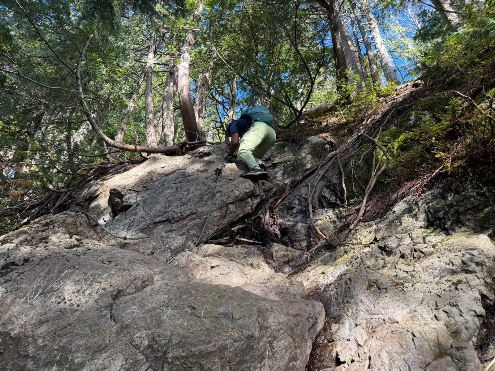
There are two fixed-rope or handline sections. On our day, the first felt like the more exposed of the two; without using the rope, I would informally compare its easiest climbing moves to approximately 5.1. That is a personal comparison, not an official Yosemite Decimal System route grade. The second step felt easier to us, with usable rock and root holds.
A fixed handline is not guaranteed protection
Inspect the rope, knots and anchor before touching them. Do not blindly load an unknown line. Keep independent handholds and footholds whenever possible, maintain three points of contact, allow only one person in the fall line, and remember that coming down may be harder than climbing up. If the rock, roots or rope are wet or icy, turning around is a sound decision.
Evans Peak summit and ridge viewpoint
The views opened as we climbed. We did not settle in for lunch at the summit; we saw the memorial plaque, took in the skyline and continued briefly along the attractive ridge beyond the high point. The continuation leads toward an airy side viewpoint, but travelling farther would only have committed us to more descent followed by a climb back to the summit. We stopped, photographed the scene and returned.
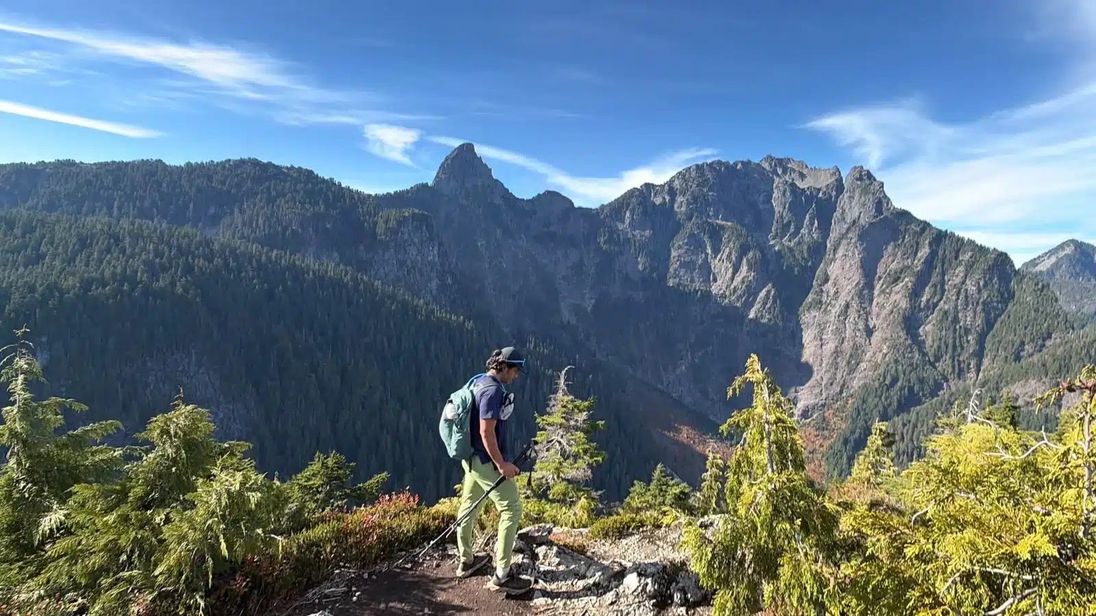
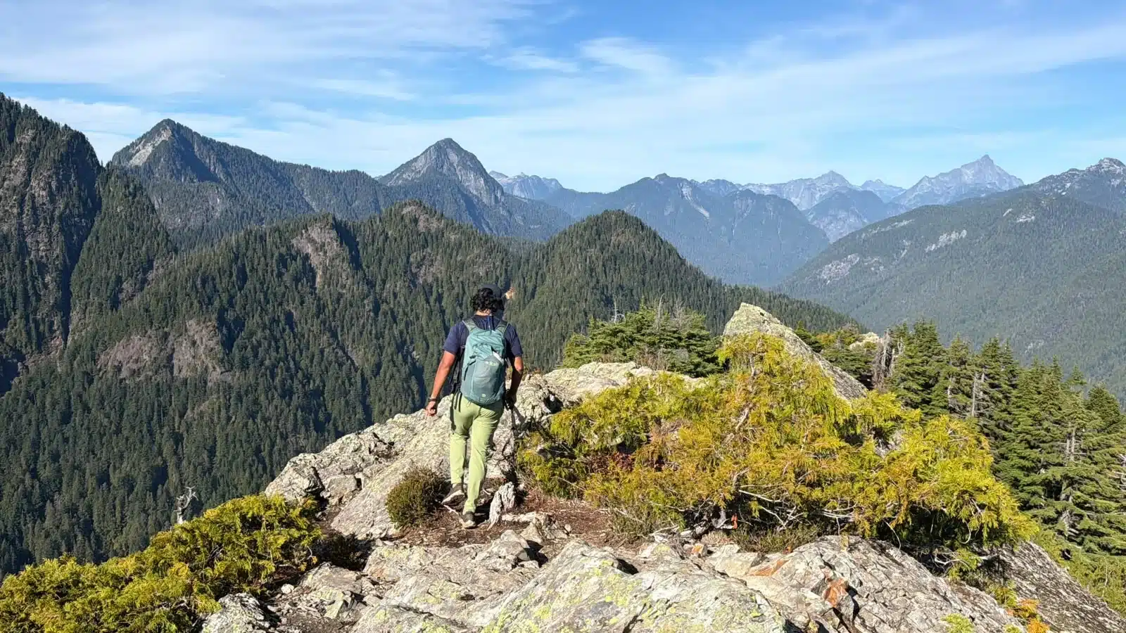
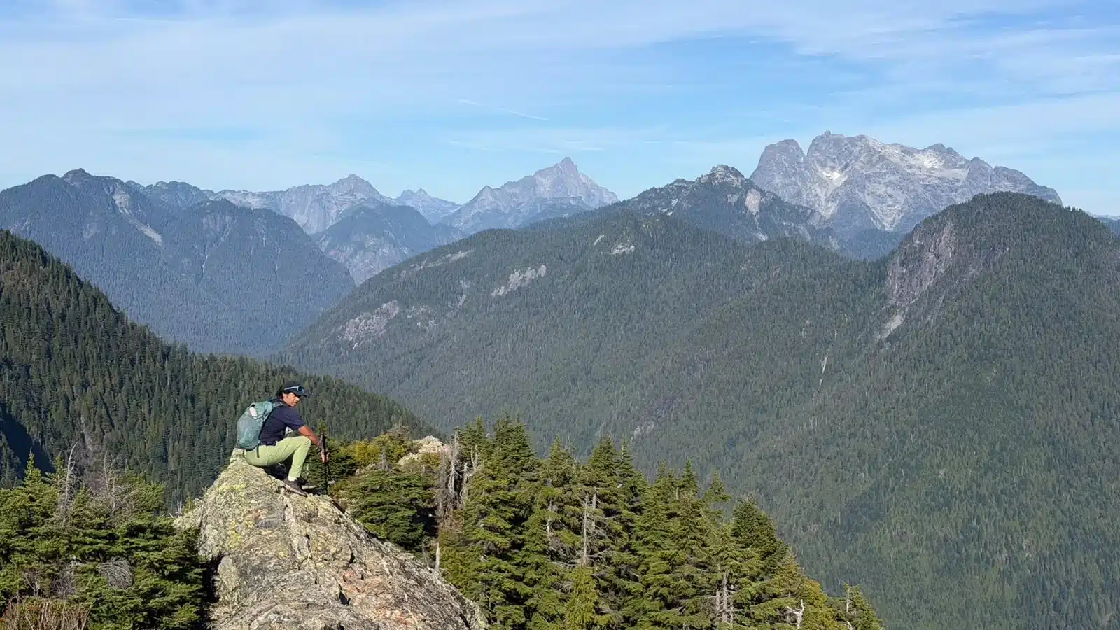
There was nobody on the summit when we arrived. We met only a few parties on the route, including hikers still going up while we descended. With October daylight already shrinking, they appeared likely to finish after dark. We drank water, took photographs and headed down promptly despite still having time in hand.
What mountains can you see from Evans Peak?
Evans Peak delivers an unusually broad panorama for its elevation. The clearest identifications from the summit and ridge include Blanshard Peak (Blanshard Needle), Edge Peak, the Golden Ears massif, Mount Robie Reid, Mount Judge Howay and The Defendant. Alouette Lake lies below; the lake visible from this summit is Alouette Lake, not Lillooet Lake.
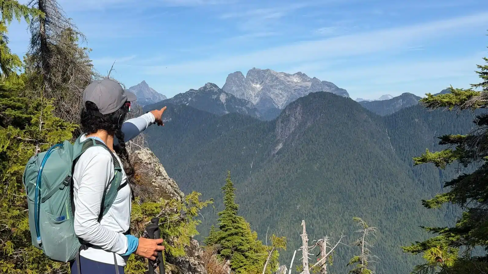
Other recognizable features around the wider skyline can include Mount Crickmer, Alouette Mountain, Mount Nutt, the Cascade Mountains and Mount Baker. On an exceptionally clear day, distant summits toward the eastern Fraser Valley may line up with the Cheam Range and the Coquihalla/Yak Peak corridor, but haze, cloud and viewing position can make those distant identifications uncertain.
The story behind Evans Peak
Evans Peak is named in memory of Lesley Evans and his 13-year-old son, John, who disappeared in this mountain country on June 6, 1966. Lesley was 39 and experienced outdoors. Despite a search lasting roughly two weeks and involving about 200 people—including police, search-and-rescue teams, military personnel and local residents—no trace of father or son was found.
The disappearance occurred in 1966, but the official naming came later. After a family and community effort, Evans Peak, Evans Valley and Evans Creek received their names in 1969. The memorial evolved over time: Lesley’s sons George and David, with members of the Signals Platoon of the First Battalion Grenadier Guards, installed a cross and plaque on the summit in July 1989. The original memorial was later replaced by the metal plaque seen today. In August 2003, the ashes of Lesley’s wife, Diane, were placed in the area according to her wishes.
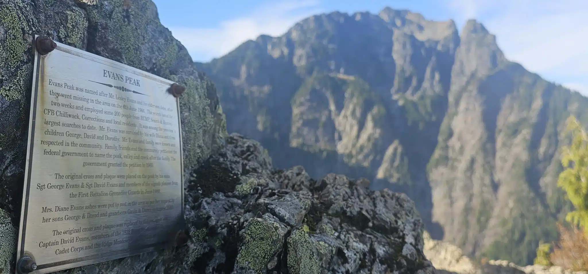
The plaque changes the summit from a viewpoint into a place of remembrance. The mountain’s name is inseparable from the father and son who did not return.
Before hiking Evans Peak
- Download the GPX offline. The upper route can be easy to leave without immediately noticing.
- Carry a headlamp. Afternoon starts and autumn daylight leave little room for delay.
- Expect wet roots. Rain makes both the ascent and descent substantially more difficult.
- Do not rush the descent. Roots and loose footing are poor terrain for trail running.
- Carry enough water. At least 500 ml is only a baseline; bring more for heat, pace, body size and delays.
- Fuel consistently. Carry food and take in calories regularly rather than waiting until energy is gone.
- Treat ropes cautiously. Inspect the handlines and anchors and maintain independent holds.
- Check current park information. Seasonal gates, access requirements, closures and conditions can change.
Would we repeat Evans Peak? Probably not immediately—not because it is a poor hike, but because Golden Ears holds many other objectives. As a last-minute mountain day, though, it was far better than doing nothing: close enough for an afternoon, serious enough to command attention and rewarding enough to recommend.
Frequently asked questions
How long is the Evans Peak hike?
Our actual recorded route was 10.69 km return, including a short optional ridge extension beyond the summit. Strava rounded the activity to 10.5 km.
How much elevation gain does Evans Peak have?
Strava calculated 991 m of elevation gain. Because GPS platforms filter elevation differently, it is best described as approximately 990 m. Our highest recorded point was 1,124.4 m.
How long did the Evans Peak hike take?
The GPX ran from 12:23:02 p.m. to 5:54:46 p.m., an elapsed time of 5:31:44. Strava displays 4:10 for the processed activity, reflecting its own time calculation.
Where does the Evans Peak hike start?
Our recording began near the West Canyon parking area in Golden Ears Provincial Park at 49.327200, -122.463104. Check official BC Parks information before travelling because access and gate conditions can change.
Are there ropes on the Evans Peak trail?
Yes. There are two fixed handline sections on steep rock-and-root terrain. Inspect each rope and anchor before use, do not treat them as certified protection and keep independent handholds and footholds.
Is Evans Peak an easy hike?
It felt relatively manageable to us at a deliberately relaxed pace, but it is not beginner-easy. The route is steep and rooty, includes rope-assisted steps and exposure, and becomes considerably harder when wet.
Is route-finding required on Evans Peak?
Some attention is required, particularly around the summit and ridge. It is possible to drift off the route without noticing immediately. Carry an offline map and the recorded GPX, but continue to navigate by the terrain.
What can you see from Evans Peak?
Clear features include Blanshard Peak, Edge Peak, Golden Ears, Mount Robie Reid, Mount Judge Howay, The Defendant and Alouette Lake. Broader views can include Mount Crickmer, Alouette Mountain, Mount Nutt, Mount Baker and the Cascade Mountains.
Why is it called Evans Peak?
The peak commemorates Lesley Evans and his 13-year-old son John, who disappeared in the area on June 6, 1966 and were never found. Evans Peak, Evans Valley and Evans Creek were officially named in 1969.
Is this an actual Evans Peak GPX recording?
Yes. The downloadable file is the watch-recorded track from this October 4, 2026 outing. It runs from the parking area through the summit, includes the short beyond-summit extension and returns to the start.
Should I hike Evans Peak when it is raining?
Wet conditions raise the difficulty substantially. Roots, slabs and rope-assisted steps can become slick, and the descent is often the crux. If traction or comfort is poor, turn around.