Normally work cuts the hike short. On Wednesday, September 30, 2026—the final day of September—the hike cut into the workday. At about noon, we decided to trade a few working hours for a small local mountain in Abbotsford. The plan sounded simple: climb the popular Abby Grind, continue along the Glen Ryder Trail and reach Taggart Peak before the afternoon was gone.
What began as a maintained, well-used fitness trail changed almost immediately beyond the Abby Grind viewpoint. Wet autumn leaves hid the ground, brush pressed against our legs, fallen trees blocked the route and two swampy sections slowed us down. The final approach then appeared to lead away from the summit before turning sharply uphill toward communication equipment and the highest point.
Our Taggart Peak hike via Abby Grind covered 11.31 kilometres with approximately 1,032 metres of cumulative ascent. This trail report includes our complete GPX track, the recorded Abby Grind time, trailhead and summit coordinates, an interactive map, elevation profile, photographs and the route-finding details that mattered beyond the popular viewpoint. It is also part of a larger record: documenting my gradual return to hiking, climbing and mountaineering after roughly a year and a half of poor health and, more recently, a calf injury.
Taggart Peak via Abby Grind hiking statistics
Hike date: Wednesday, September 30, 2026
Location: Sumas Mountain, Abbotsford, BC
Route: Abby Grind and Glen Ryder Trail to Taggart Peak
Route type: Out and back
Recorded distance: 11.31 km
Cumulative ascent: Approximately 1,032 m
Highest GPS elevation: Approximately 793 m
Net rise to highest point: Approximately 784 m
Total elapsed time: 3 hr 28 min 5 sec
Time to Abby Grind viewpoint: About 35 min 52 sec
Time to Taggart Peak high point: 1 hr 56 min 17 sec
Descent from summit area: About 1 hr 27 min
Recorded start: 1:24:46 p.m. PDT
Recorded finish: 4:52:51 p.m. PDT
Difficulty: Moderate physically; route-finding required beyond Abby Grind
Conditions: Wet ground, autumn leaves, overgrowth, deadfall and swampy sections
These measurements come from our complete GPX recording. Cumulative ascent includes the smaller climbs and dips along the route and can vary between devices because of elevation smoothing. The highest GPS elevation is a recorded reading, not a surveyed summit elevation.
Why we chose a local Abbotsford hike
We often stay away from smaller local mountains. Some routes are too short to feel like a full mountain day, while others demand hours of bushwhacking only to end at a forested summit with little or no view. For us, the view-to-effort ratio can be difficult to justify.
The previous Sunday had reinforced that feeling. On a route near Harrison, the bushwhacking continued almost all the way toward the peak. We had not brought a cutting tool, thick vegetation slowed every step and a bear was close on my right. I could hear its breathing. I pulled out the bear spray and yelled loudly to make our presence known. Frustrated by the brush and uncomfortable with the encounter, we turned around. We may return when snow covers the undergrowth and the route can be approached as a properly planned winter outing.
By Wednesday, we wanted something short, close to home and straightforward. Abby Grind looked like the right workout. Ironically, the route to Taggart Peak eventually gave us another dose of the exact thing we had hoped to avoid.
Taggart Peak and Abby Grind trailhead
The Taggart Peak route begins from the same gravel parking area used for the Abby Grind, near the Abbotsford Fish & Game Club. The popular lower section is also known as part of the Glen Ryder Trail. Gunfire from the nearby range can be audible around the trailhead and lower mountain; hearing shots here does not necessarily mean someone is on the hiking trail.
Driving from Vancouver or central Abbotsford
Use Highway 1 eastbound and take Exit 95 at Whatcom Road. Cross the highway, turn onto North Parallel Road and follow the local-road connection through Atkinson Road back to North Parallel Road. Turn north onto McDermott Road, cross the Sumas River and continue to the gravel parking area near the fish and game club. Use the live directions above because construction, access and parking arrangements can change.
Driving from Chilliwack
Take Highway 1 westbound to Exit 104 at No. 3 Road. Join North Parallel Road and continue west before turning right onto McDermott Road. Cross the Sumas River and proceed to the gravel trailhead area. Follow all posted parking and access signs.
Recorded coordinates: Our GPS began at 49.080549, −122.160283 at approximately 9 m elevation. It ended 32 m away at 49.080486, −122.160708. These are track points from our outing, not surveyed property boundaries or guarantees of legal parking.
Climbing the Abby Grind
We reached the trailhead at approximately 1 p.m. and started the GPS recording at 1:24:46 p.m. The opening section looked well maintained, and compared with many steep backcountry hikes around Chilliwack, the grade felt manageable. It was still steep enough to provide a useful workout but short enough to fit into an afternoon.
The Abby Grind was clearly popular. We passed a defined trail, completion markers and signs of regular use. The climb is not flat or effortless, but it is more approachable than the long, sustained ascents found on many Fraser Valley mountain routes.
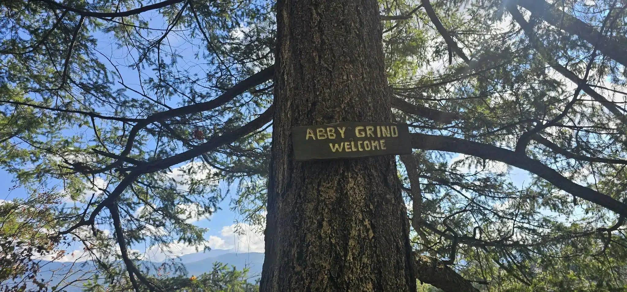
Our GPX reached the rocky Abby Grind viewpoint at approximately 2:00:38 p.m., about 35 minutes 52 seconds after we started. The viewpoint was roughly 1.75 km along our recorded route at 49.086574, −122.164896.
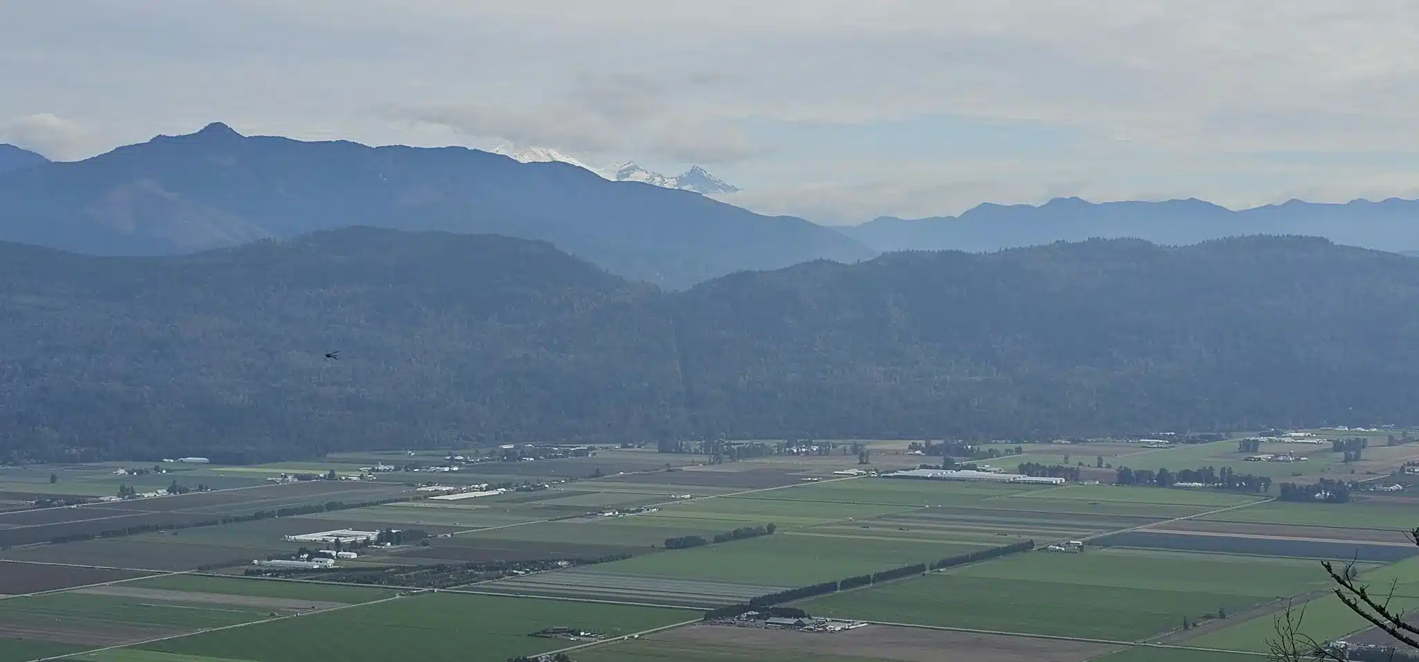
The opening looks across Abbotsford and Sumas Prairie. Farmland spreads below, Highway 1 cuts across the valley and Mount Baker rises beyond the southern skyline when visibility allows. This is the main payoff for most Abby Grind hikers—and the point where the busy workout trail and the quieter Taggart Peak extension become two very different experiences.
Beyond Abby Grind: the route becomes overgrown
We knew the route beyond the viewpoint would not be maintained to the same standard. Even so, the change was immediate. The broad, obvious Abby Grind gave way to an overgrown forest path. Autumn leaves covered the ground, rain from the previous day left the vegetation wet and the brush scraped against my running tights.
We do not enjoy bushwhacking, and within a short distance we were already debating whether to continue. Several fallen trees crossed the route. Some could be stepped over, while others forced us to climb around, duck beneath branches or make a short traverse beside the original line.
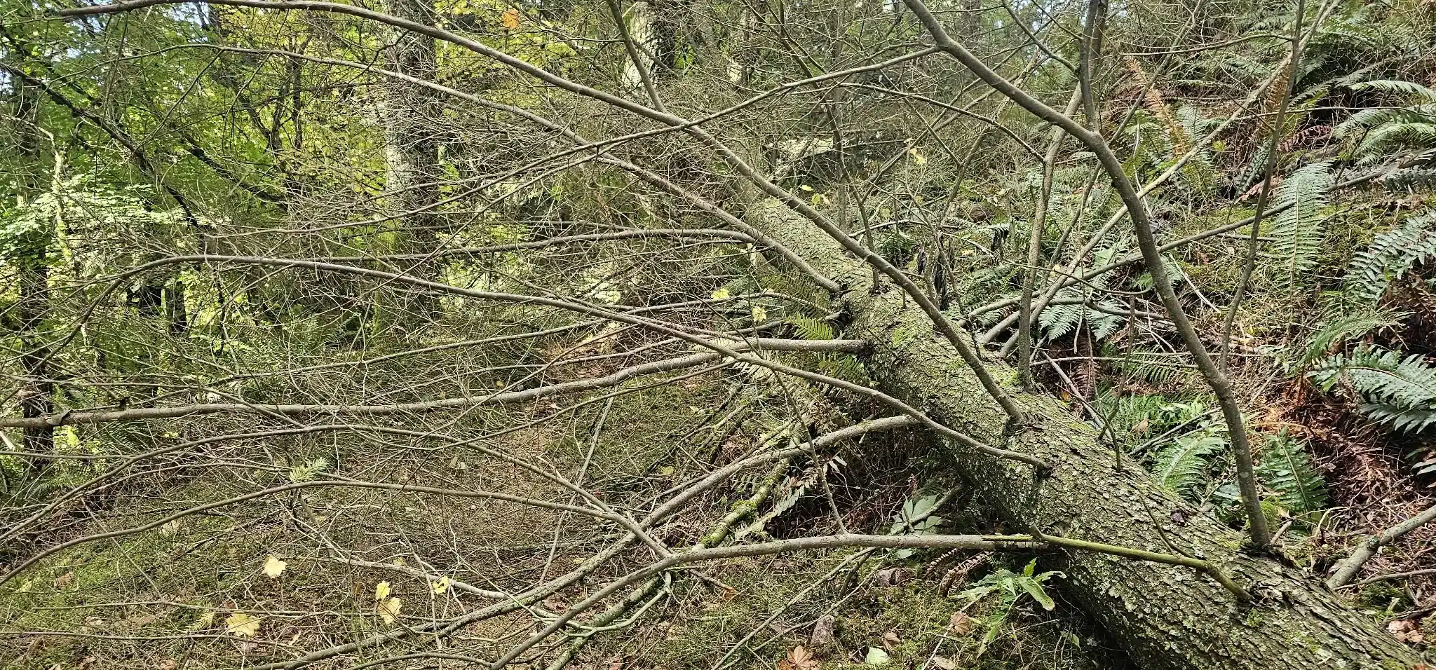
We continued. The middle portion rolled through repeated rises and dips rather than climbing continuously. In dry summer conditions, parts of this ridge could be runnable. On this outing, wet leaves made the ground slippery, so we kept the pace controlled. The route also crossed two swampy areas and entered sections where the forest became especially thick.
Navigation, the Garmin track and a false sense of descending
I had the GPX route loaded on a solar Garmin watch. That gave us a continuous reference and, if we turned around, a breadcrumb line leading back toward the start. The watch was extremely useful, but no GPS device makes it impossible to become lost. Batteries, files, reception, maps and judgment can all fail. Anyone continuing beyond Abby Grind should carry an offline route on more than one device and be prepared to reverse the track.
At one point, the route dropped into darker forest. The downhill direction felt wrong, but the watch still showed us on track. We followed it, reached a more open area and then climbed a steep slope on the other side. Later, the forest became strangely echoing. Our voices carried through the trees, making that section feel eerie and enclosed.
Bear awareness in the thick forest
Because the vegetation was high and the route curved repeatedly around blind corners, we talked and called out as we moved. The Harrison encounter from three days earlier was still fresh in our minds. We had not brought our bear banger, but I kept bear spray immediately accessible rather than buried inside the pack.
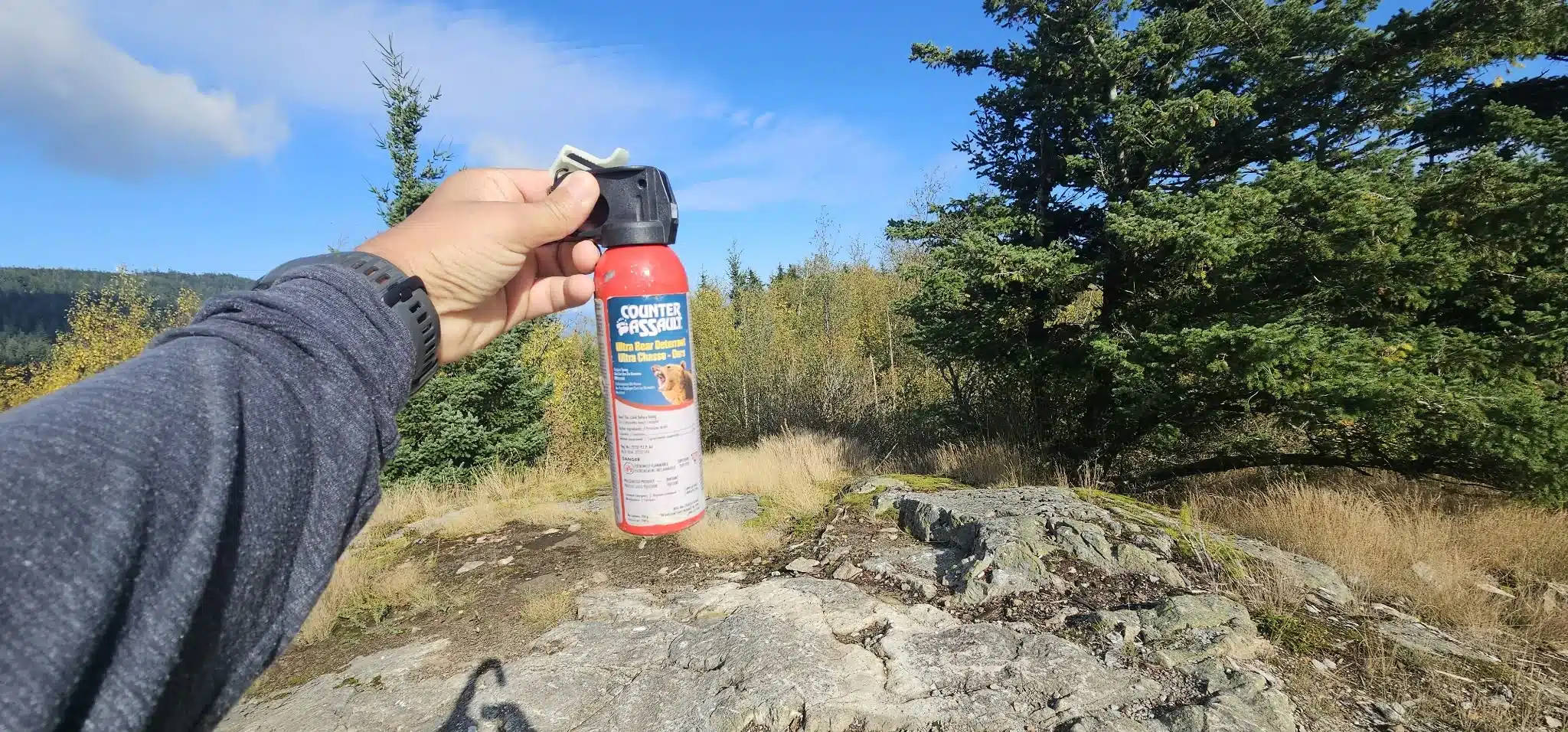
Important: Bear spray is useful only if it is accessible and the carrier knows how to deploy it safely. Wildlife behaviour is unpredictable. Check current guidance, travel in a prepared group when possible, avoid surprising animals and never rely on noise from the nearby shooting range as a substitute for bear awareness.
The confusing final approach to Taggart Peak
About 24 vertical metres below the highest point, the route became confusing again. The path appeared to wrap around the mountain rather than climb toward the top. For a moment, it looked as though we had missed the summit and were descending off the other side.
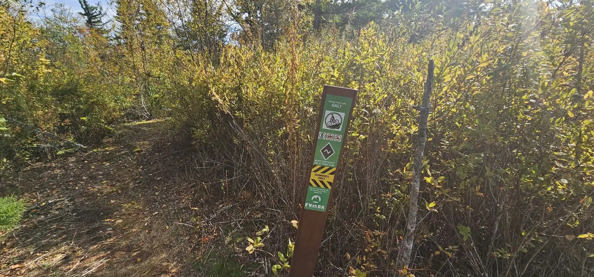
We kept moving a little farther. The trail then turned very steeply uphill. Because the soil was still damp from the rain, our footwear could bite into the ground. In dry, loose conditions, the same final slope could be much less secure. We climbed the steep pitch, stepped through small rocks and emerged near a trail marking for Salty Nozzle, a mountain-bike line in the upper trail network.
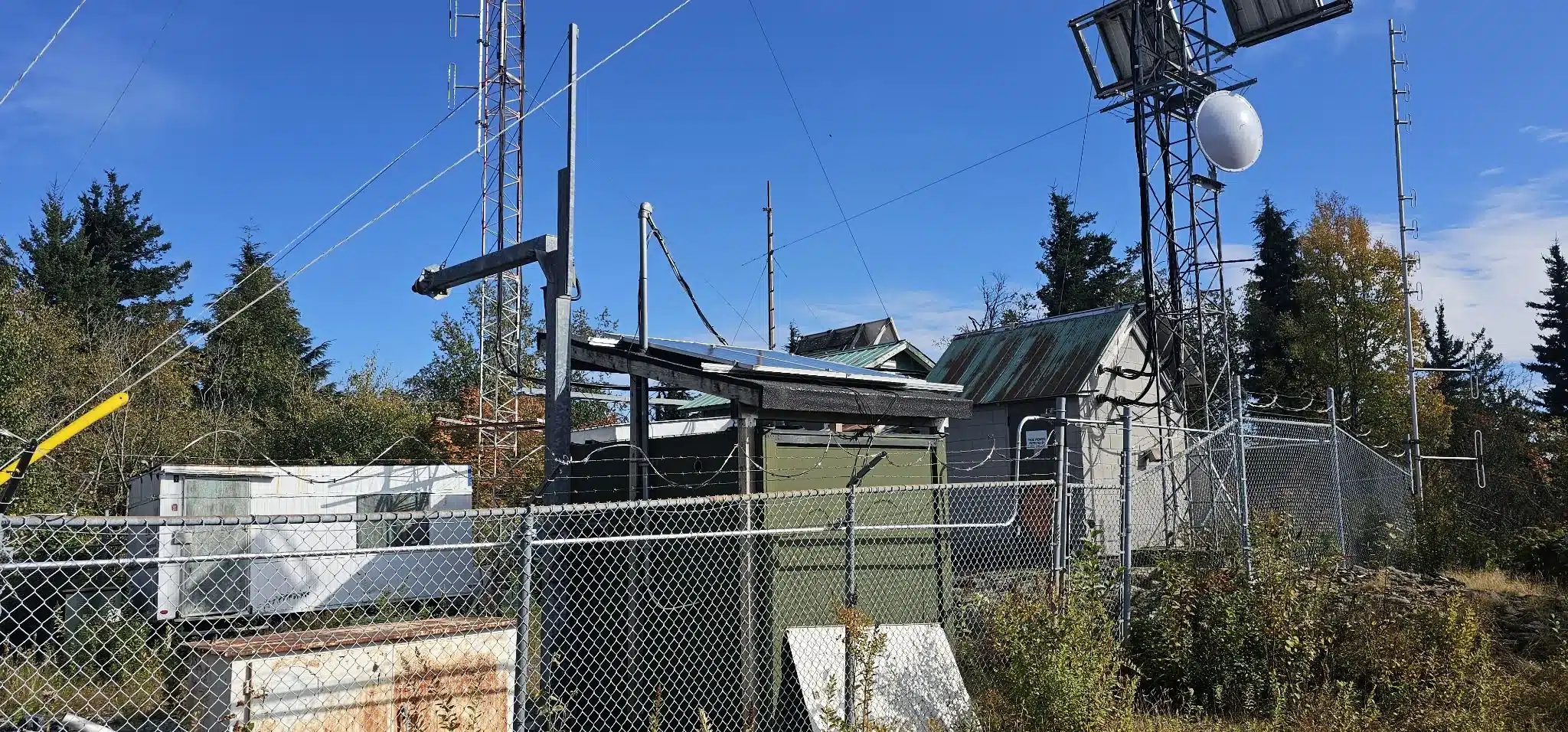
From there, the route opened at a fenced communications site with towers, equipment and solar panels. We travelled around the installation and continued north to the highest recorded point.
What mountains can be seen from Taggart Peak?
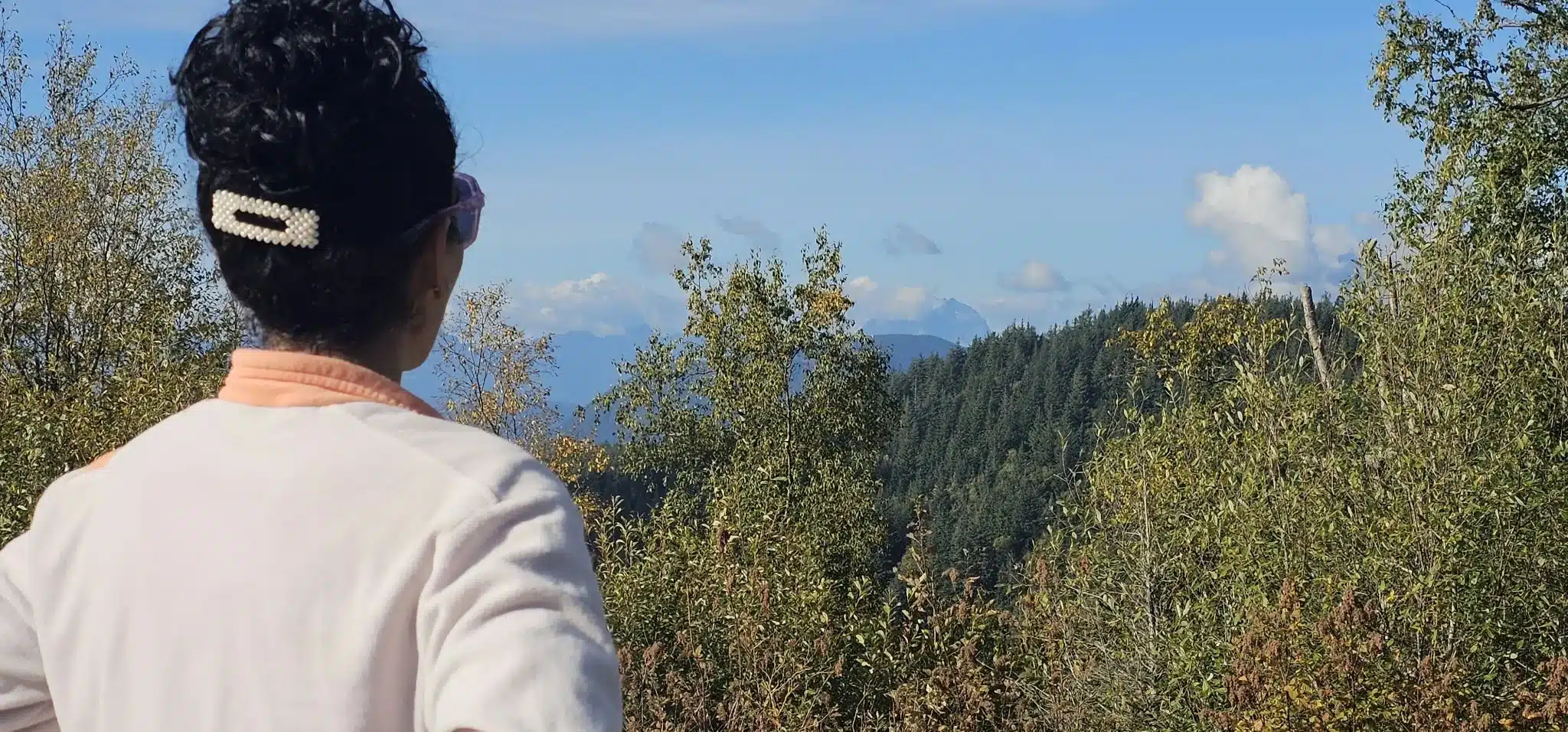
The forest and communications infrastructure interrupt the panorama, but openings around the summit provide partial views in several directions. Depending on cloud and where you stand, the recognizable skyline can include Mount Robie Reid, Mount Kranrod, Mount Judge Howay, the Golden Ears range, Sumas Mountain and Mount Baker. Sumas Prairie and the wider Fraser Valley are visible from lower openings and the Abby Grind viewpoint.
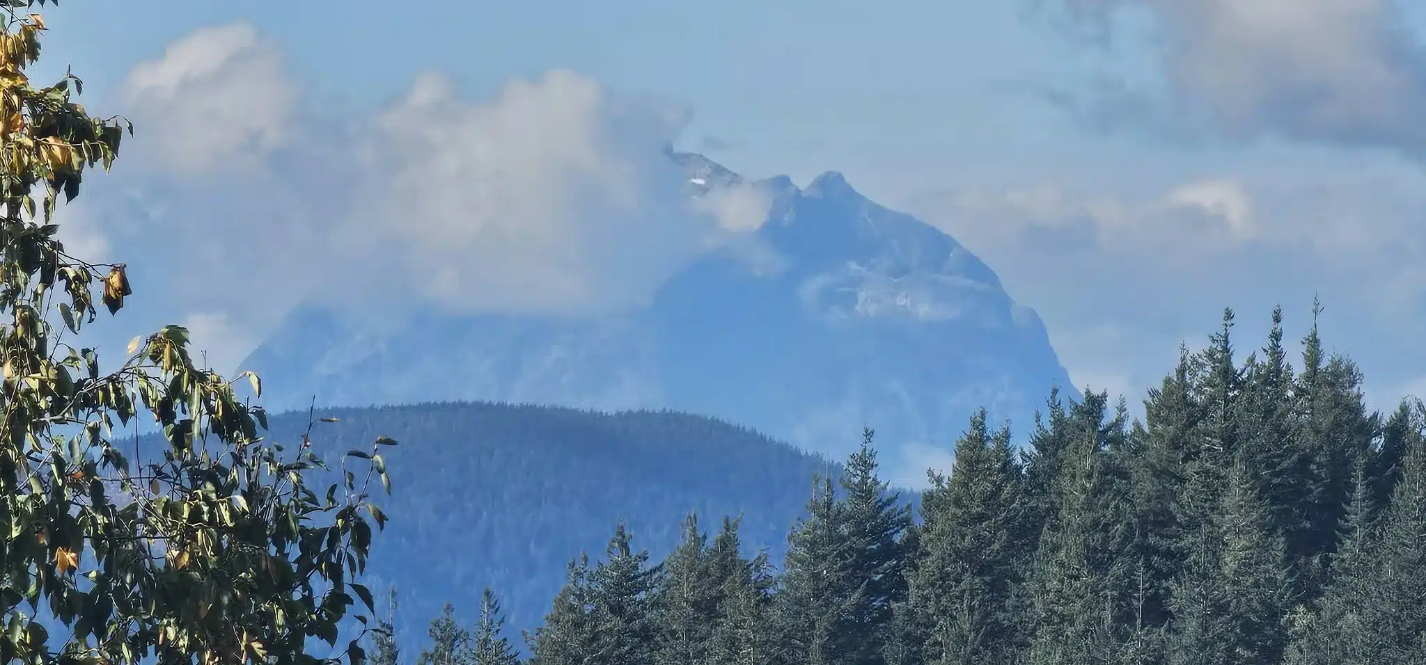
On our visit, cloud wrapped parts of the northern mountains. We could still photograph the view toward Mount Robie Reid, Mount Kranrod and Mount Judge Howay, with the higher forms appearing and disappearing behind the cloud.
Where Robie Reid, Kranrod and Judge Howay sit from Taggart Peak
The three northern peaks are not spread evenly across the skyline. From our highest Taggart Peak GPS point, Mount Robie Reid lies to the left, while Mount Kranrod and Mount Judge Howay are almost directly aligned with one another. Kranrod is closer and lower; Judge Howay stands approximately 3.6 km farther away on nearly the same bearing.
| Peak | Approximate elevation | Bearing from Taggart | Direction | Straight-line distance | Relationship in the view |
|---|---|---|---|---|---|
| Mount Robie Reid | 2,095 m | 337° true | North-northwest | Approximately 39.4 km | About 7° left of Kranrod and Judge Howay |
| Mount Kranrod | 1,817 m | 343° true | North-northwest | Approximately 42.9 km | Almost directly in front of Judge Howay from this viewpoint |
| Mount Judge Howay | 2,262 m | 344° true | North-northwest | Approximately 46.6 km | Nearly the same sightline as Kranrod, but farther away and higher |
Bearings are approximate degrees clockwise from true north. Distances are great-circle measurements from our highest recorded Taggart Peak point at 49.105592, −122.141841 to the official BC geographical coordinates for Mount Robie Reid, Mount Kranrod and Mount Judge Howay. They are not hiking or expedition distances.
The highest GPX reading occurred at 3:21:03 p.m. at 49.105592, −122.141841, with a recorded elevation of 792.8 m. We did not need a long lunch stop for this outing. We ate bars, drank water, took photographs and began the return. Our track remained within the upper summit area from approximately 3:18:44 to 3:26:02 p.m.—about seven minutes including movement.
Looking toward future Robie Reid and Judge Howay expeditions
Seeing Mount Robie Reid and Mount Judge Howay from Taggart Peak carried personal significance. I have been eyeing both mountains as future expedition objectives for some time. They are far more serious and remote than this local hike, and the view did not mean I was immediately ready to attempt them. It was a reminder of where I eventually wanted my recovery and training to lead.
My health had been down for approximately a year and a half, keeping me below my usual level of hiking, climbing and mountaineering. The calf injury then created another limitation just as I was trying to rebuild. On Taggart Peak, however, my general health and the calf both seemed to be recovering well. I could complete the climb, handle the rolling forest and descend without the setback that had shaped some of the earlier outings.
I have started documenting these hikes because the return itself matters. The GPX files, photographs, timings, route conditions and honest notes about the body create a record of rebuilding—from local training hikes such as Abby Grind and Taggart Peak toward larger mountain objectives. Recovery is not proven by one successful afternoon, but this outing felt like another step toward resuming regular hiking and mountaineering activity.
The descent: a little running, but caution on wet leaves
Once we knew the route, the return felt more direct. A few flatter sections were runnable, and we jogged briefly where the footing allowed. We avoided running the steeper descents because fallen leaves concealed roots, wet soil and uneven ground.
We passed the Abby Grind viewpoint area again at approximately 4:29:41 p.m. and reached the recorded finish at 4:52:51 p.m. The complete outing lasted 3 hours 28 minutes 5 seconds.
The GPX shows no meaningful wrong turn. Minor deviations around the main line correspond to deadfall, obstacles and movement near the communications equipment. For the conditions we encountered, this is an unusually precise record of the route we actually used from the Abby Grind parking area to Taggart Peak and back.
How long did Taggart Peak via Abby Grind take?
Our full recording ran from 1:24:46 p.m. to 4:52:51 p.m. PDT. The stage times below include photography, brief discussions about turning around, obstacle crossings and short stops.
| Stage | Recorded time | Elapsed or stage duration | Recorded distance point |
|---|---|---|---|
| Start at Abby Grind trailhead | 1:24:46 p.m. | Start | 0.00 km |
| Abby Grind viewpoint | About 2:00:38 p.m. | 35 min 52 sec from start | About 1.75 km |
| Enter upper summit area | About 3:18:44 p.m. | 1 hr 53 min 58 sec from start | About 5.53 km |
| Highest recorded point | 3:21:03 p.m. | 1 hr 56 min 17 sec from start | 5.67 km |
| Leave upper summit area | About 3:26:02 p.m. | About 7 min in upper area | About 5.83 km |
| Return past Abby Grind viewpoint | About 4:29:41 p.m. | 1 hr 8 min 38 sec after high point | About 9.54 km |
| Recorded finish | 4:52:51 p.m. | 3 hr 28 min 5 sec total | 11.31 km |
Stage locations were identified from the track geometry, elevation readings and known route features. The Abby Grind viewpoint is the rocky southwest opening at the end of the steep lower climb. “Summit area” is a practical GPS boundary around the upper communications site, not a precisely timed rest period.
Taggart Peak via Abby Grind GPX map and elevation profile
The official Strava activity below displays our real recorded route from the Abby Grind trailhead to the viewpoint, through the overgrown Glen Ryder Trail extension and up to Taggart Peak, followed by the complete descent and return. The Strava panel provides the genuine activity map together with the recorded distance, climbing and elevation information.
This is our actual recorded GPX from September 30, 2026—not a planned line or a route downloaded from another hiking app or website. Many publicly shared GPX files are older user uploads, estimated routes or tracks recorded under different trail conditions, so they may not precisely match the trail on the ground. Apart from small movements around fallen trees, other obstacles and the summit equipment, this track follows the route we physically travelled from the Abby Grind trailhead to Taggart Peak and back. It remains a GPS recording rather than a surveyed trail, and conditions can change.
Navigation warning: This GPX records our route accurately, but it does not convert the Taggart Peak extension into a maintained or risk-free trail. Deadfall, vegetation, mud, snow and trail work can change the line. Use current information, carry offline navigation and turn around if the route becomes unclear.
Is Taggart Peak via Abby Grind worth hiking?
For a local workout and a short adventure, yes. Abby Grind offers the strongest view-to-effort ratio: a defined, popular climb with a broad Fraser Valley viewpoint. Taggart Peak adds distance, cumulative climbing, forest travel and route-finding rather than a dramatically better summit panorama.
The route suited what we needed that Wednesday. It was close to Abbotsford, long enough to provide a meaningful workout and short enough to complete in one afternoon. The experience also confirmed why many people stop at the Abby Grind viewpoint. Beyond it, wet brush, fallen trees, swampy ground and faint trail can demand much more attention than the modest distance suggests.
We could imagine returning in winter with snowshoes, but snow would also bury the faint track, obscure holes and logs and make navigation more consequential. That would require a fresh assessment of snow depth, weather, daylight, equipment and route conditions—not simply the assumption that snow will make the bushwhacking easier.
Taggart Peak and Abby Grind: frequently asked questions
How long is Taggart Peak via Abby Grind?
Our complete out-and-back GPX recorded 11.31 km. The highest point was 5.67 km into the track, and the recording ended about 32 m from the exact starting point.
How long did the Taggart Peak hike take?
Our total elapsed time was 3 hr 28 min 5 sec, from 1:24:46 to 4:52:51 p.m. PDT. We reached the highest recorded point in 1 hr 56 min 17 sec.
What was our Abby Grind time?
Our GPX reached the rocky Abby Grind viewpoint approximately 35 min 52 sec after the start, at about 2:00:38 p.m. The recorded distance to that point was approximately 1.75 km.
How much elevation gain did the route have?
Our GPX recorded approximately 1,032 m of cumulative ascent. The highest GPS elevation was 792.8 m, about 784 m above the first recorded elevation. GPS platforms may report different ascent totals after smoothing.
Is the trail to Taggart Peak maintained and marked?
The Abby Grind section is popular and comparatively easy to follow. Beyond its viewpoint, our route was overgrown in places, covered by wet autumn leaves and interrupted by fallen trees. Trail and mountain-bike markings exist in the upper network, but route-finding was still necessary.
Is there bushwhacking between Abby Grind and Taggart Peak?
We encountered brush rubbing against our legs, dense vegetation, deadfall and two swampy sections. A faint path existed, so this was not continuous off-trail travel, but it felt like bushwhacking in the most overgrown places.
What can you see from Abby Grind and Taggart Peak?
The Abby Grind viewpoint overlooks Abbotsford, Sumas Prairie, Highway 1 and Fraser Valley farmland toward Mount Baker. Openings around Taggart Peak can provide partial views toward Mount Robie Reid, Mount Kranrod, Mount Judge Howay, the Golden Ears range, Sumas Mountain and Mount Baker, although trees, communications equipment and cloud can obstruct them.
Is this an actual recorded GPX or a planned online route?
This is the GPX recorded while we physically completed the hike on September 30, 2026. It is not an estimated line or a route downloaded from another app or website. The track includes small movements around fallen trees, other obstacles and the summit equipment. It is still a consumer GPS recording rather than a surveyed trail, and future trail conditions may differ.
Can Taggart Peak be snowshoed in winter?
The rolling ridge may appear suitable for snowshoes, but winter snow can conceal the already faint route, fallen timber and swampy ground. Attempt it only with appropriate winter equipment, navigation skills, current weather and snow information and enough daylight.
Why can gunshots be heard near the Abby Grind trailhead?
The trailhead is beside the Abbotsford Fish & Game Club area, so shooting-range noise is common near the lower route. Follow signs and remain on the established hiking access.
More Fraser Valley trip reports: Flora Peak in Chilliwack, 79 Grind in Mission and Bear Mountain in Mission.
Route context was checked against the Vancouver Trails Abby Grind guide and the Best Hikes BC Taggart Peak guide. All outing-specific distances, times, elevations and coordinates above come from our September 30, 2026 GPX recording.