Flora Peak had been on our list for years. On September 20, 2026, a last-minute change of plan finally took us there. The climb brought early autumn colours, an unexpected encounter with a deer and her two young, and the mountain views we had hoped for. But just below the summit, one step onto a boulder aggravated my injured calf. Getting back down became the hardest part of the day.
Our Flora Peak hike in Chilliwack, British Columbia covered 13.14 kilometres with approximately 1,413 metres of cumulative ascent. This is our account of the climb and descent, with the complete GPX route, trailhead coordinates, photographs, summit video and a breakdown of what the recorded times actually mean.
Flora Peak hiking statistics: our September outing
Hike date: Sunday, September 20, 2026
Location: Chilliwack Lake area, BC
Recorded distance: 13.14 km
Cumulative ascent: Approximately 1,413 m
Highest GPS elevation: 1,951 m
Net rise to highest point: Approximately 1,312 m
Total elapsed time: 6 hr 53 min 42 sec
Strava displayed time: 5 hr 5 min
Strava distance: 13.5 km
Strava elevation gain: 1,324 m
Ascent, including pauses: About 3 hr 37 min
Descent, including pauses: About 2 hr 37 min
Summit / upper-ridge window: About 40 min
Our difficulty assessment: Strenuous
Route: Out and back, with early backtracking
Recorded start: 49.099046, −121.458383
Statistics describe our recorded outing, including a missed turn and movement near the summit. GPS ascent varies with elevation noise and smoothing. The highest GPS reading is not a surveyed summit height. Strava figures are verified from the embedded activity and listed separately from our GPX calculations; see the timing explanation below.
A bigger objective became a long-awaited Flora Peak hike
Flora Peak was not our original objective that morning. We had planned a bigger mountain, but there had not been enough sleep the night before. My left calf was also still recovering from an injury during a training trail run the previous weekend.
It felt much better, though not completely recovered. I had adjusted my training and spent time rehabilitating it before this outing. We had managed the 79 Grind in Mission on Friday. By Sunday, I wanted to see how my fitness held up on a longer, more sustained climb.
After roughly a year and a half away from my usual level of sport, hiking, climbing and mountaineering, I had been working toward getting back into shape. Flora Peak had remained on the list for several years. At the last moment, we decided this would be the day to try it.
At the start, my attention was mostly on endurance: how far had I come, and how would I feel after several hours of climbing? By the descent, the calf had become much more important than the fitness test.
Flora Peak trailhead: directions from Vancouver and Chilliwack
Use the Post Creek / Lindeman Lake parking area as your driving destination. BC Parks identifies Post Creek as the shared trailhead for Lindeman, Greendrop and Flora Lake. Our Flora Peak route starts from this access area.
Driving from Vancouver
Take Highway 1 east toward the Fraser Valley. One established approach uses Exit 104, then No. 3 Road through the Tolmie Road connection to Yarrow Central Road. Continue toward Vedder Mountain Road and join Chilliwack Lake Road at Vedder Crossing. Follow Chilliwack Lake Road east for roughly 40 km, watching for the signed Lindeman Lake parking entrance on the left before Chilliwack Lake. Vancouver Trails estimates about 2 hr 15 min from Vancouver; traffic and your starting point can add considerably to that.
Driving from Chilliwack
Head south through Sardis on Vedder Road to Vedder Crossing, then join Chilliwack Lake Road eastbound. Continue up the valley to the signed Post Creek / Lindeman Lake parking area. Use the live directions below for the road junctions and a travel-time estimate from your starting location.
Access references: BC Parks and Vancouver Trails’ Lindeman Lake directions. Directions links use our recorded access-area start; obey posted access and parking signs. BC Parks notes limited reception along this road, so download your maps before leaving coverage.
Parking and walking to the Flora Lake turn
We started from the Lindeman Lake trailhead area off Chilliwack Lake Road. The parking lot was overflowing when we arrived, and we parked along the road. Many people appeared to be heading toward the lake, while the summit route felt much less busy.
GPS recording start: 49.099046, −121.458383
Recording began: 10:49:06 a.m. PDT
Open the recorded start in Google Maps
These coordinates mark the first GPX point in the trailhead access area, not a surveyed trail sign or designated parking spot. The recording does not separately establish our car-arrival time. Follow posted parking restrictions.
Trailhead and summit GPS coordinates
| Location | Latitude, longitude | What the pin represents |
|---|---|---|
| Trailhead / parking access area | 49.099046, −121.458383 | Our first recorded point; elevation approximately 639 m. |
| Summit GPS point | 49.113613, −121.428926 | Highest recorded point at 2:31:43 p.m.; elevation approximately 1,951 m. |
From the parking access area, enter the shared trail system and watch for the early right turn signed Flora Lake. Take that branch for our Flora Peak route. We initially missed it, walked beyond it and returned; the turn was then on our left. The GPX includes this brief backtrack.
Coordinates are decimal degrees from our GPX. The exact parked-car position and signed junction were not separately marked, so neither has been assigned an invented coordinate. The summit pin is our highest recorded position, not a surveyed summit marker.
One reason we had delayed this hike was concern about reports of vehicle break-ins around trailheads in the area. BC Parks also specifically warns about break-ins at the Lindeman Lake parking lot. That concern had kept us away from several Chilliwack hikes. Seeing people coming and going made us feel more comfortable on this visit, although a busy parking lot does not guarantee security.
Check BC Parks’ Chilliwack Lake Park information and notices for current access information before heading out.
The ascent: a missed turn, then almost continuous climbing
We began hiking as soon as we entered the trailhead area—and promptly missed the first sign for Flora Lake. Heading in, it was a right turn. We walked a little farther, realised our mistake and retraced our steps. Coming back toward the junction, the turn was now on our left.
That small detour is included in our GPX. If you follow the recorded route, remember that the backtrack near the beginning was a mistake, not an extra section of trail you need to repeat.
At first, the climbing seemed manageable and not particularly steep. As we continued, that changed. The trail became steeper and more sustained, with very little flat ground to settle into a comfortable walking rhythm. There were short easier stretches, but they never lasted long.
For most of the ascent, things went reasonably well. I was doing more of the climbing with the other leg, avoiding as much forceful pushing through the injured left calf as I could. I could keep moving, but I was already compensating.
I also made an effort to fuel and drink more consistently. I ate some carbohydrates on the way up and carried my own hydration pack, drinking through the hose as we climbed. With the water readily accessible, it was easier to keep drinking during the steady uphill work.
A deer encounter just before the ridge
Before we reached the ridge, I turned on the camera. About five seconds later, a deer appeared ahead with two younger deer following her—one noticeably larger than the other. The timing was pure coincidence.
They noticed us and stood looking in our direction while I took pictures and recorded some video. After hours of concentrating on the trail and the climb, suddenly our attention was on this small family sharing the mountain with us.
They moved on. A little farther along, I saw the adult again, and she noticed me at the same moment. I spoke very quietly: “I’m a friend.” She appeared to stamp a foot. I took it as a warning, perhaps to her young, although I cannot know what she intended.
I had no wish to frighten them. We had simply come across one another on the same stretch of mountain. Apart from a few small squirrels, this was our main wildlife encounter—and one of the moments I remember most clearly.
Autumn colours and the final approach
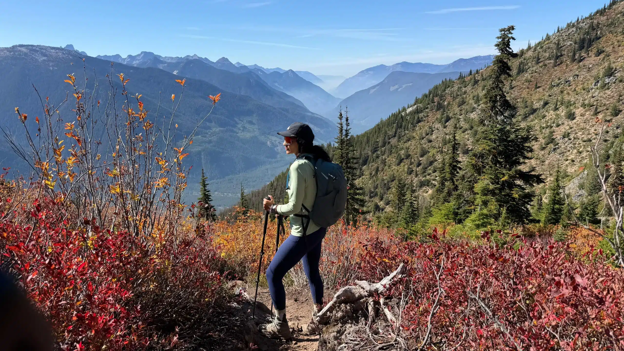
Higher up, the views opened across the surrounding ridges. Red and gold shrubs brightened the slopes, evergreens stood against the rocky ground, and the mountains stretched into the distance. The early change of colour gave us another reason to pause.
This was the part of the hike I had imagined when Flora Peak first went on the list. After so much climbing, the open mountain scenery felt like a reward. It also made me think about returning to other hikes in the area as autumn progressed.
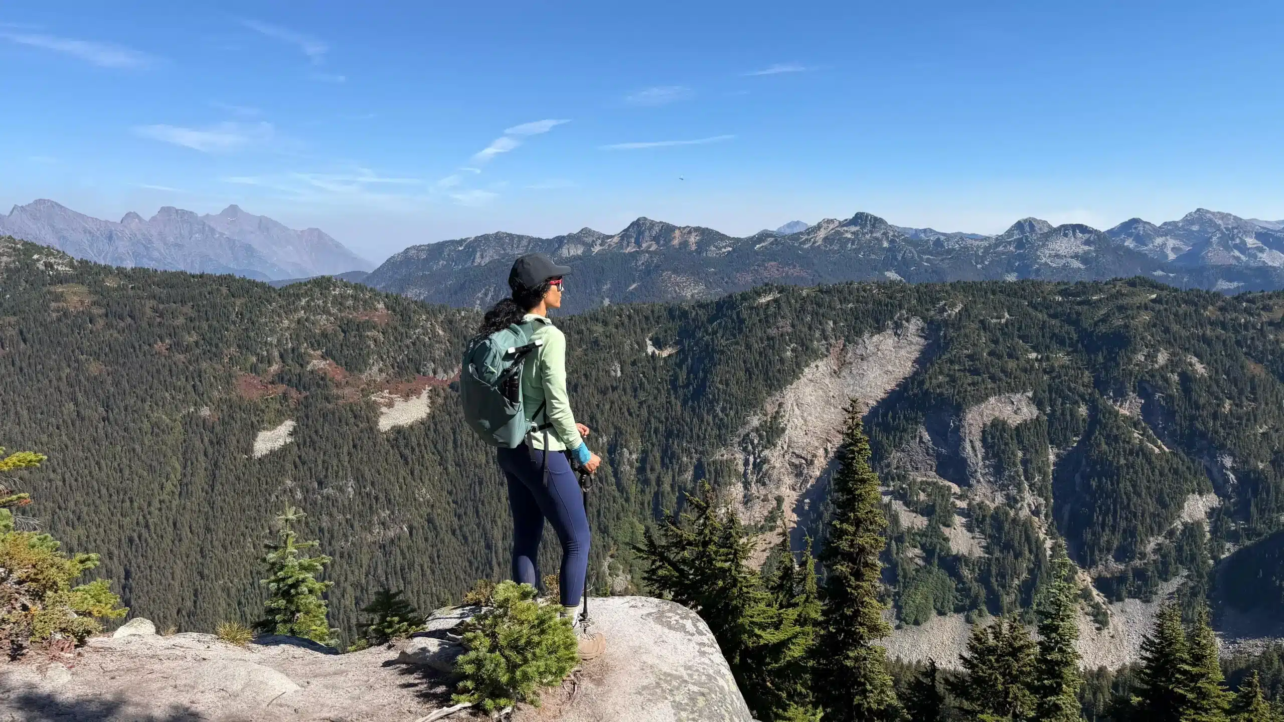
The boulder below the summit
Just below the summit, I came to a large boulder and placed my left foot on it. To climb up, I had to press through the leg with the injured calf.
I heard a small noise in the calf. It felt overstressed, and the pain returned.
I managed the final climb and reached the summit, but the character of the day had changed. Until then, I had been thinking about my improving fitness. Now I had to think about getting back down with a painful leg.
The GPS cannot identify that exact step or tell me what happened inside the calf. What I know from the experience is that it hurt after that movement and continued hurting throughout the descent.
Flora Peak summit: lunch, photographs and video
At the top, we had lunch, took photographs and spent time enjoying the views. After years of putting the hike off, we were finally there.
Our track reaches the summit area at approximately 2:26 p.m. The highest recorded point occurs at 2:31:43 p.m., with a GPS elevation of 1,950.6 metres. We remained around the summit and upper ridge until roughly 3:06 p.m.
That is about forty minutes in the upper area, including movement as well as stops. It is not a precise measure of how long we sat down for lunch.
How long did our Flora Peak hike take?
The complete recorded outing took 6 hours 53 minutes 42 seconds. That includes the wrong turn, stops along the trail, photographs, lunch and movement around the summit.
| Stage | Time, PDT | Duration |
|---|---|---|
| Ascent to the summit area | 10:49:06 a.m.–about 2:26:15 p.m. | About 3 hr 37 min, including pauses |
| Summit and upper ridge | About 2:26:15–3:05:49 p.m. | About 40 min, including movement |
| Descent to the recorded finish | About 3:05:49–5:42:48 p.m. | About 2 hr 37 min, including pauses |
| Whole outing | 10:49:06 a.m.–5:42:48 p.m. | 6 hr 53 min 42 sec elapsed |
| Strava displayed activity time | Verified from the public embed; labelled “Time” | 5 hr 5 min |
Strava time and GPX elapsed time
The Strava activity displays 13.5 km, 1,324 m of elevation gain and 5 hr 5 min under “Time”. These figures have been checked against the public embed below.
The GPX timestamps span 6 hr 53 min 42 sec from start to finish, including all stops. The difference from Strava’s displayed time is approximately 1 hr 49 min. The embed does not explicitly label its figure as moving or elapsed time, so this difference should not be treated as a precisely measured total of rest breaks.
Separate ascent and descent times excluding every break are not available from the public embed. Our 3 hr 37 min ascent and 2 hr 37 min descent are elapsed stage estimates from the GPX. Removing the upper-area window leaves approximately 6 hr 14 min for the ascent and descent combined, still including pauses elsewhere on the trail.
The GPX calculation gives 13.14 km and approximately 1,413 m of cumulative ascent, compared with Strava’s 13.5 km and 1,324 m. These are separately sourced measurements; the exact processing behind their differences has not been established.
Using the GPX distance and full elapsed time, our overall average was approximately 1.91 km/h including stops. Using Strava’s displayed distance and time gives approximately 2.66 km/h. Neither is a flat-ground walking pace or a complete assessment of fitness.
Our recorded Flora Peak activity on Strava
Open the activity on Strava if the embedded card does not appear.
Method: start and finish timestamps come directly from the GPX. Approximate stage boundaries use the track’s entry into and final departure from the upper summit area, around 1,940 m on ascent and 1,930 m on descent. These are practical timing boundaries, not precisely recorded arrival, lunch or departure events. All times are local Pacific daylight time.
The descent: extremely hard on the knees with an injured calf
Coming down was extremely hard on my knees. The trail was steep, the calf hurt throughout, and losing all that elevation was much more uncomfortable than I had hoped. The summit was behind us, but the difficult part was far from over.
On the climb, I had been able to do more work with the other leg. Descending the same sustained gradient with the calf now hurting made each downhill section more demanding. The steepness that had tested my endurance on the way up was now especially hard on my knees.
This is the part that a simple time comparison misses. The descent took less time than the ascent, but it did not feel easier. A faster downhill time does not mean the leg was comfortable or that the injury was insignificant.
We reached the recorded finish at 5:42:48 p.m. I was pleased to have finally visited Flora Peak, but there was no mistaking how much the calf had affected the return.
What this hike told me about my fitness
Completing more than thirteen kilometres with over 1,300 metres of net climbing was encouraging after so much time away from my previous activity level. I could sustain a long mountain day, and much of the ascent had felt manageable despite the continuous climbing.
My impression was that my general fitness was coming back faster than my calf was recovering. That is how the day felt; one GPS track cannot establish exactly how much fitness I have regained or whether an injury has healed.
Flora Peak gave me a useful picture of both sides of the recovery. There was progress in endurance, and there was also a clear limit in the leg. Before deciding on another demanding outing, I needed to pay attention to how the calf responded and continue reassessing it.
Flora Peak GPX map and elevation profile
This map follows our complete recorded route, including the early missed turn, the climb, movement around the summit and the return. We climbed Flora Peak and came back; this track is not the longer Flora Lake–Greendrop–Lindeman circuit.
Download the complete Flora Peak GPX file for use in your mapping app.
Loading the recorded route and elevation profile… If the map does not appear, use the GPX download above.
The track documents our outing, including a navigation mistake. It should be used alongside current trail information and your own navigation. Start and summit markers identify recorded GPS positions.
Is Flora Peak worth the climb?
For us, yes. The open views, early autumn colours and deer encounter made it a memorable day. After years of leaving it on the list, I was glad we finally went.
It also deserves to be treated as a substantial hike. A busy shared trailhead can make the start feel casual, but our route involved a long, sustained climb and a steep descent. The return asks plenty of your legs, especially if you are already compensating for an injury.
I would remember this as a rewarding mountain day with a difficult finish: encouraging for my endurance, uncomfortable for the calf and knees, and a reminder to judge an outing by the whole journey rather than the summit alone.
Flora Peak hike: frequently asked questions
How long is the Flora Peak hike?
Our GPS recorded 13.14 km, including a small wrong turn near the start and movement around the summit. Other recordings can differ with route choices and GPS processing.
How much elevation gain did this route have?
Our raw GPX gives approximately 1,413 m of cumulative ascent and 1,312 m of net rise from the recorded start to the highest point. The highest recorded elevation was approximately 1,951 m.
How long did the ascent and descent take?
Approximately 3 hr 37 min uphill to the summit area and 2 hr 37 min downhill, both including pauses. We spent about 40 min around the summit and upper ridge. The whole recording lasted 6 hr 53 min 42 sec.
Was the hiking time 5 hours 5 minutes?
Strava’s public activity embed displays 5 hr 5 min under “Time.” Our GPX spans 6 hr 53 min 42 sec including stops. The embed does not provide separate break-free ascent and descent times.
Where does the Flora Peak route start?
We began in the Lindeman Lake trailhead access area off Chilliwack Lake Road. Our first GPS point was 49.099046, −121.458383. Look for the early Flora Lake turn; we initially missed it.
Is Flora Peak difficult?
We found it strenuous because of the sustained climbing and steep descent. With an aggravated calf, coming down was particularly hard on my knees. Our experience should not be read as advice to hike through an injury.
More local trip reports: 79 Grind in Mission and Bear Mountain in Mission.